Tomorrow morning, many of us will slide behind the wheel without a second thought. Coffee secure in the cup holder. Climate-controlled air humming quietly. A familiar podcast filling the car as smooth pavement unspools ahead.
It feels ordinary—until you realize you are traveling along the descendants of a single road that once decided whether the United States would hold together at all.
Two centuries ago, this route was known first as the Cumberland Road, and later as the National Road. It was America’s first federally funded highway, built to push through mountains, link distant regions, and bind a fragile nation still unsure of its future.
Picture making that same trip in the early 1800s. You are wrestling a heavy wooden wagon over jagged rock, axle-deep mud, and corduroy roads made of loose logs that rattled bones and snapped wheels without warning. Travel wasn’t inconvenient. It was exhausting, dangerous, and slow in ways that are hard to fathom today.
Before the United States built the National Road, distance wasn’t measured only in miles. It was measured in broken axles, drowned livestock, delayed mail, and weeks lost to weather and terrain—yet these crude paths were all settlers had.
From Animal Trails to Native American Pathways
Long before any American road was surveyed, paved, or even named, movement across the continent followed far older logic. The earliest routes were shaped by migrating animals, which instinctively chose ridgelines, river crossings, and gentle grades that offered the easiest passage through dense forests and rugged terrain. Over generations, these natural corridors became reliable paths etched into the landscape.
Native American communities adapted and refined these animal trails into footpaths, linking villages, hunting grounds, and trade networks that spanned vast distances. These routes were not random wanderings; they reflected deep geographic knowledge, seasonal rhythms, and practical engineering choices long before the word “engineering” applied.
From Indigenous Trails to Colonial Roads
When European colonists arrived, they did not invent new roads so much as inherit existing ones. They widened Indigenous footpaths to accommodate horses, wagons, and military traffic, pressing ancient routes into new service. Early American roads were rarely planned from scratch. Most were adaptations—expanded trails, seasonal tracks, or former military routes—many of which could still turn treacherous overnight.
Braddock’s Road is a prime example—and it wasn’t born from scratch. Much of the route followed Nemacolin’s Trail, a well-established Native American path through the mountains that traders and travelers already relied on. In 1755, during the French and Indian War, British General Edward Braddock widened and strengthened that corridor to move troops and heavy wagons toward Fort Duquesne.
Braddock’s aide-de-camp during this expedition was a young George Washington, gaining firsthand experience with the logistical limits of frontier travel.
What emerged was less a “road” than a bruising military supply line: narrow, stump-filled, and notoriously unforgiving. Wagons broke down. Travelers were stranded. Progress came at a punishing pace.
Still, the lesson mattered. Braddock’s Road proved that the Alleghenies could be crossed by a consistent overland route, even if doing so came at a steep cost in time, money, and equipment. It revealed the strategic stakes of overland access. Decades later, parts of that same corridor would be refined into the Cumberland Road—better known as the National Road—transforming a punishing military track into the backbone of a nation moving west.
A Nation Separated by Geography
As the young nation expanded westward after the Northwest Ordinance of 1787, a deeper problem emerged. The Allegheny Mountains formed a massive physical and economic barrier between the eastern states and the growing western territories that would become Ohio, Michigan, Indiana, Illinois, and Wisconsin.
Crossing that barrier could take weeks. A spring thaw could double the journey. A broken wheel or injured animal could halt it entirely.
George Washington saw the danger early.
While traveling through the western territories in 1784, he observed that settlers there stood, as he put it, “as it were on a pivot.” Their loyalty would follow trade routes, not political borders. Without reliable connections to the East, commerce—and allegiance—might drift toward foreign powers instead.
The need, as Washington wrote, was to “…bind those people to us by a chain which never can be broken.”
Politics, Power, and the Long Road to Action
Washington was hardly alone in recognizing the danger, but turning that insight into action proved far more difficult. For nearly two decades, the young federal government was paralyzed by a fundamental constitutional question: did it even have the authority to build roads within the states?
Strict constructionists argued that the Constitution granted no such power, and that so-called “internal improvements” were the responsibility of individual states. Any premature federal action risked igniting a crisis over state sovereignty.
There were practical setbacks as well. Washington himself initially wagered on waterways rather than roads, investing heavily in canal schemes along the Potomac River in hopes of carving a navigable route through the mountains. Years of effort revealed the limits of that gamble—the terrain was too steep, too rocky, and too unpredictable for a reliable canal system.
Meanwhile, Congress experimented with cheaper stopgaps like Zane’s Trace, a narrow bridle path authorized in 1796 that could carry mail and pack horses, but not the heavy wagons settlers depended on.
Only with Ohio’s path to statehood did a workable solution emerge. Under the Ohio Enabling Act of 1802, the federal government agreed to dedicate a portion of land-sale proceeds to the construction of a road connecting the new state to the East. It was a carefully crafted compromise—one that avoided constitutional overreach while finally clearing the way for a true national highway.
See more early 19th-century survey maps of the National Road.
The Cumberland Road: A Federal Gamble That Changed Everything
In 1806, President Thomas Jefferson pushed the issue forward. Congress approved construction of a federally funded road that would link the Atlantic states to the western frontier.
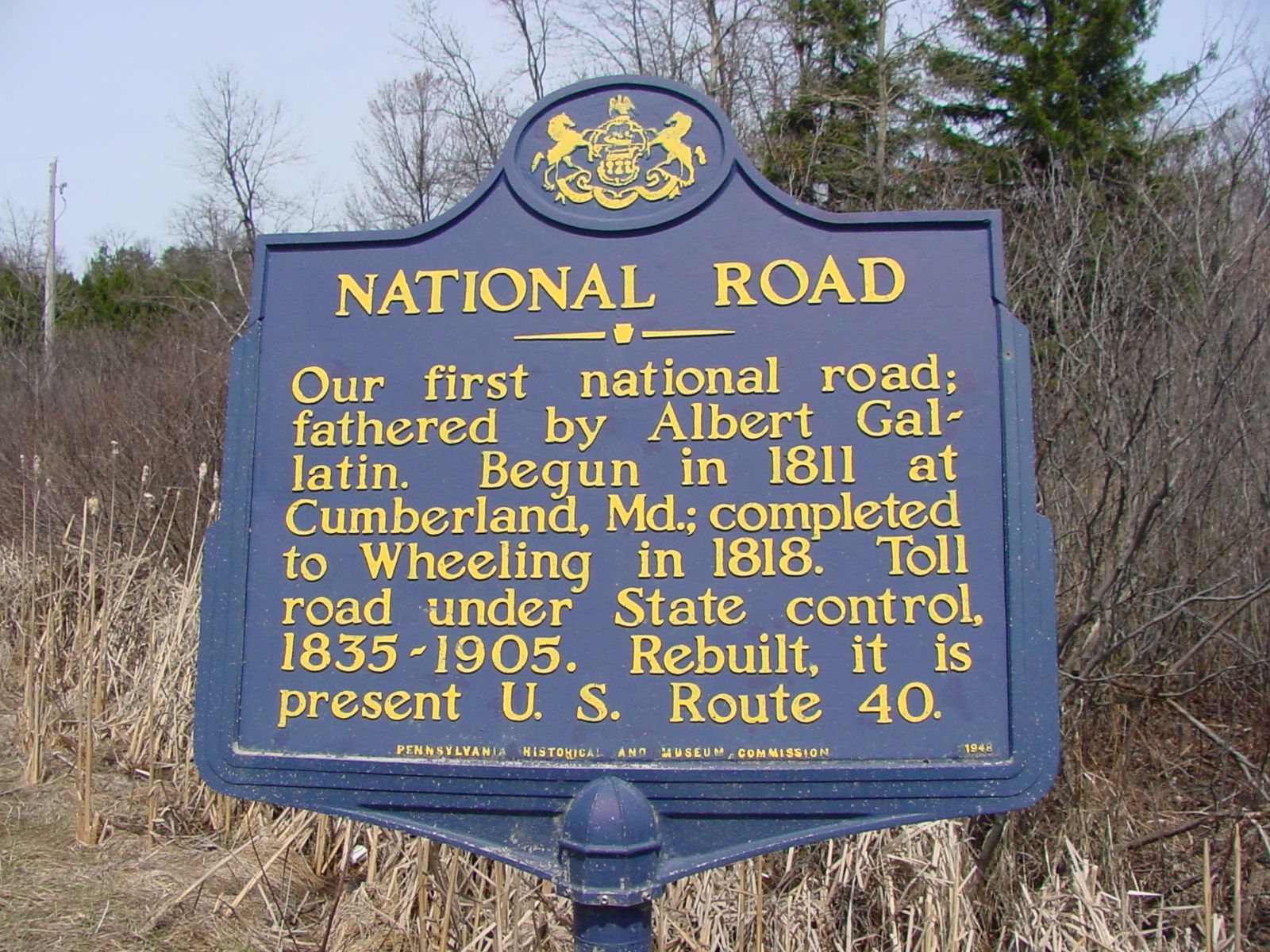
It was officially called the Cumberland Road, after its eastern starting point in Cumberland, Maryland. But history would remember it by the name that mattered more: the National Road.
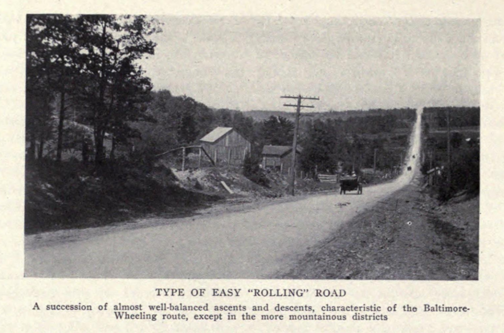
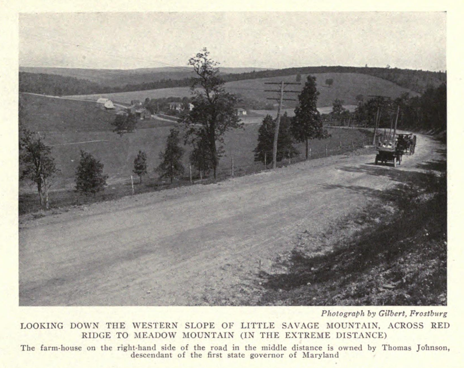
This was not a hacked-out trail. It was a deliberate feat of engineering.
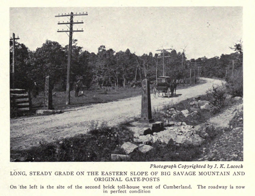
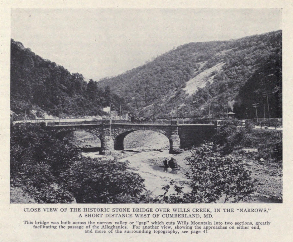
Surveyors graded slopes to reduce dangerous climbs. Drainage systems kept the surface passable in wet weather. Stone bridges replaced crude log crossings. Cast-iron mileposts marked distance with quiet confidence. For the first time, America built a road designed not just to exist—but to last.
Travel that once took weeks could now be measured in days.
But the National Road was never effortless. Even with improved grading and stone surfacing, sections turned treacherous during spring thaws and heavy rains, when mud could swallow wagon wheels to the hub. Maintenance was constant and costly, and responsibility for repairs shifted uneasily between federal, state, and local authorities.
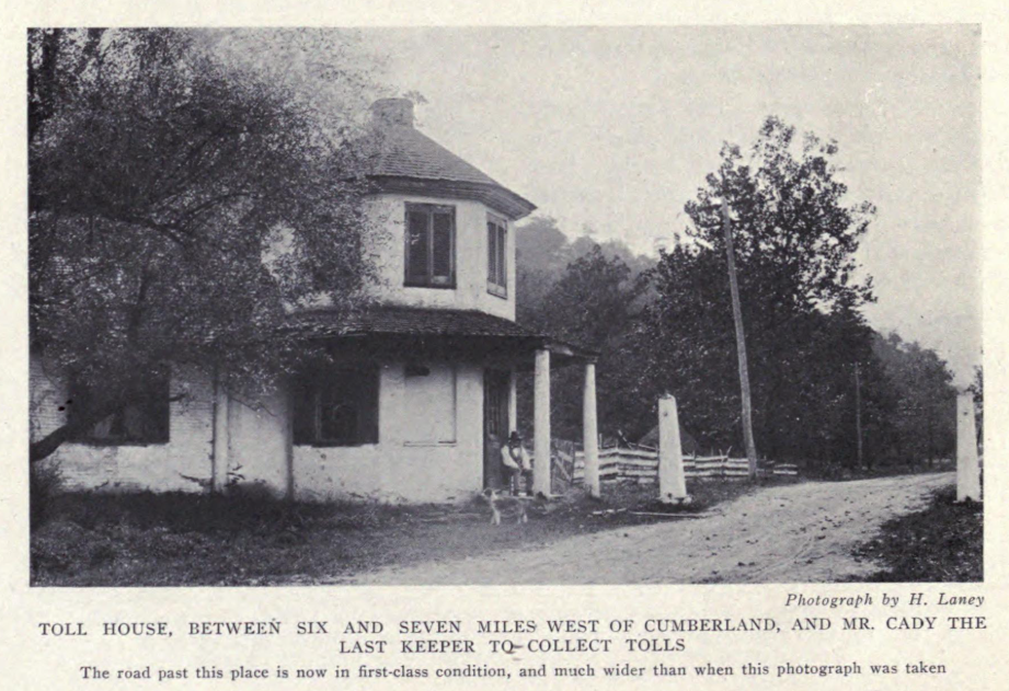
To help fund upkeep, tollhouses appeared along the route—small structures where travelers paid fees based on the number of animals, wagons, or livestock they drove. These tolls sparked frequent complaints and occasional evasion, reminding everyone that even America’s first great highway came with friction, expense, and limits.
Following an Old Path—and Perfecting It
Much of the National Road followed the general alignment of Braddock’s Road, which had already revealed a workable corridor through the Alleghenies. Engineers refined the route, smoothing grades, widening the roadway, and replacing obstacles with durable infrastructure.
This blend of old knowledge and new engineering allowed the road to push steadily westward.
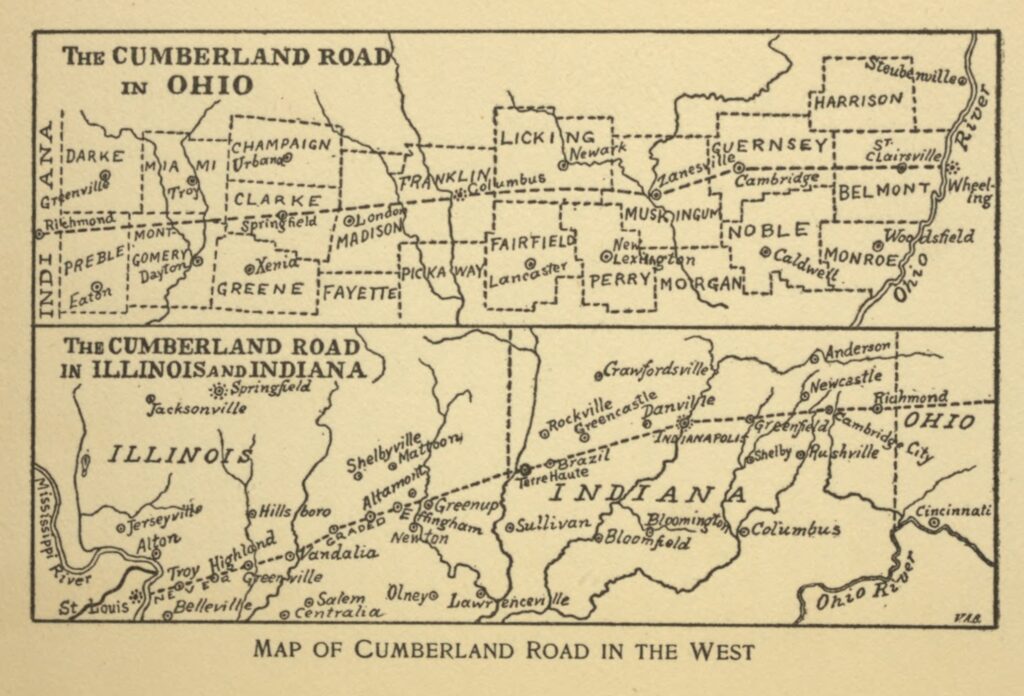
By 1818, it reached Wheeling, then part of Virginia. Over the next two decades, construction continued in stages until the road finally extended to Vandalia, Illinois, in 1839—then the edge of the American frontier.
For the first time, the United States had a reliable overland spine linking east and west.

Boomtowns Built on Wheels
The effects were immediate and visible.
Towns appeared almost overnight, plotted directly along the road. Taverns, inns, blacksmith shops, and general stores clustered at regular intervals, first as rest stops, then as permanent settlements.
Cities like Uniontown, Brownsville, Wheeling, Washington, and Cumberland flourished. Others owed their very existence to the road’s path.
Columbus, Ohio became the state capital because the National Road passed through it. Indianapolis was designed around the route, its wide streets planned to accommodate constant traffic. Without this highway, many Midwestern cities might never have taken shape at all.
The Fast Lane of a Young Nation
The National Road did more than just move people. It rewired daily life along its route.
Freight costs dropped sharply. A wagonload of grain that once cost more to haul than it was worth could now reach eastern markets at a profit, allowing farmers in Ohio and Indiana to compete for the first time. Goods, money, and opportunity flowed both directions, creating the country’s first truly national economy.
Ideas moved just as quickly. Newspapers that once arrived weeks late now reached frontier towns while the news was still fresh. Political debates followed the same route, stitching distant communities into a shared national conversation. By the 1820s, nearly half of all settlers heading into the Midwest traveled along the National Road.
It became a corridor not just of migration, but of culture—one that carried entertainment, ideas, and argument as efficiently as it moved goods.
Traveling performers, preachers, politicians, and circus troupes followed the same route. Frontier taverns doubled as theaters, pulpits, and debate halls. American culture itself rolled west on wagon wheels.
Engineering the Future of American Roads
The National Road set standards that still shape highways today.
Among its most important innovations was macadam construction, developed by Scottish engineer John Loudon McAdam. By layering compacted, angular stone, engineers created a hard, well-drained surface that resisted ruts and weather.
Compared to muddy tracks that dissolved after rain, macadam roads were revolutionary.
The road also inspired ambitious engineering projects, including the Wheeling Suspension Bridge, once the longest suspension bridge in the world. Dozens of original stone bridges along the National Road still stand today—many built from local limestone and preserved as historic landmarks.
They are quiet proof that good infrastructure endures.
The Road You Still Drive
The National Road never disappeared. It evolved.
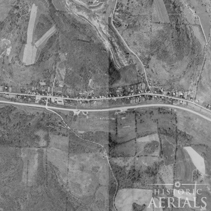
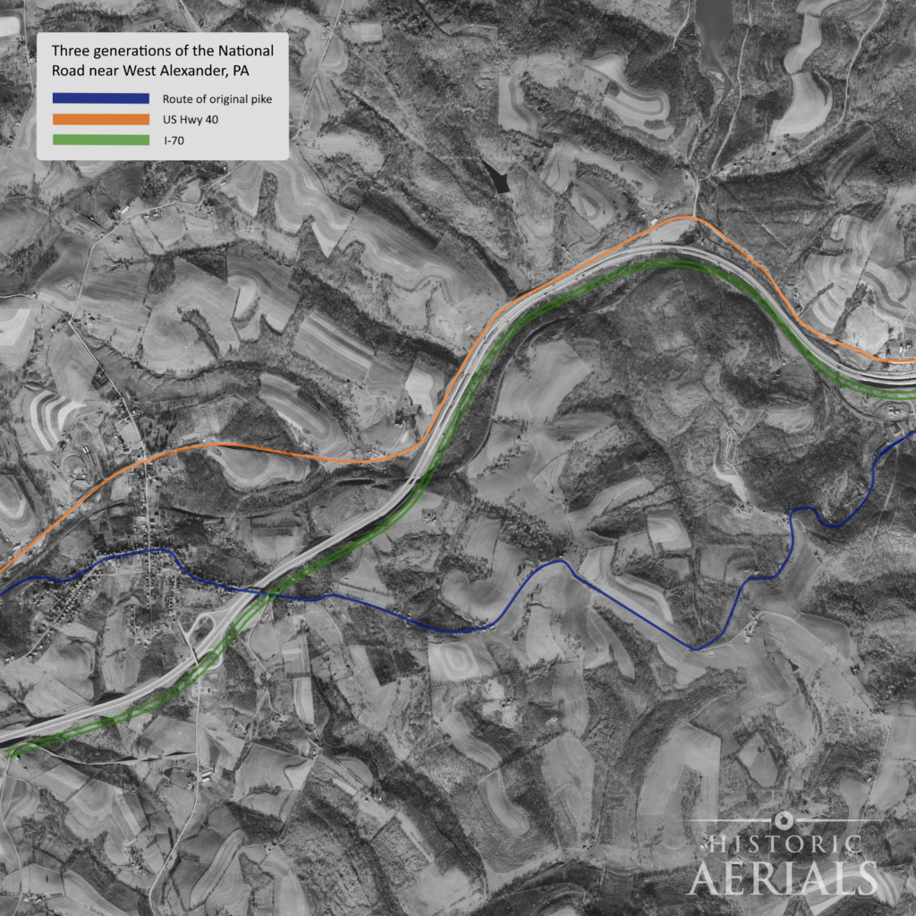
As transportation needs changed, the road itself was repeatedly straightened, realigned, and bypassed. Early segments that followed the land closely—winding along riverbanks or easing over ridgelines—were gradually replaced by straighter, faster routes engineered for heavier traffic and higher speeds. Older alignments often fell out of primary use, becoming local roads, frontage roads, or quiet remnants alongside their successors.
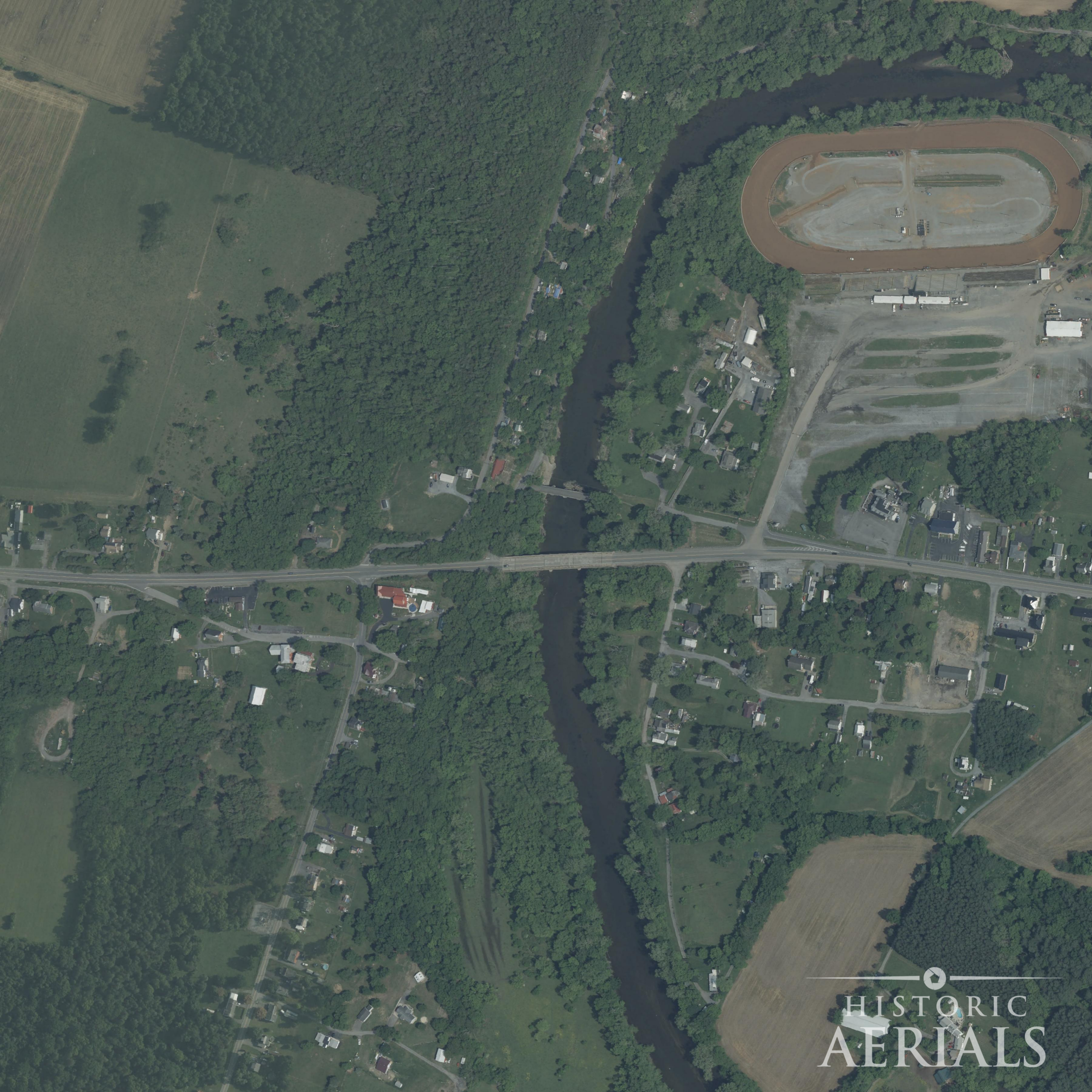
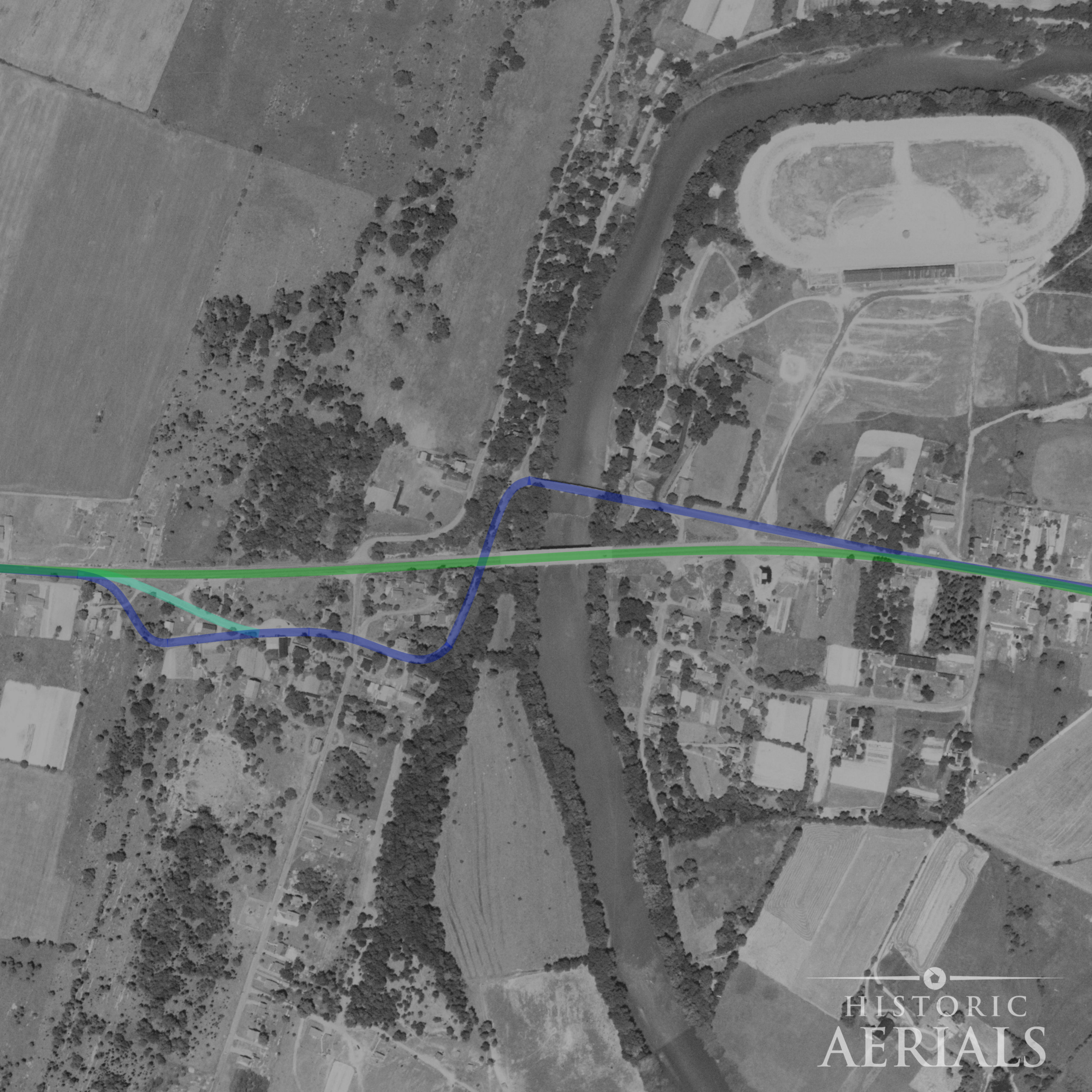
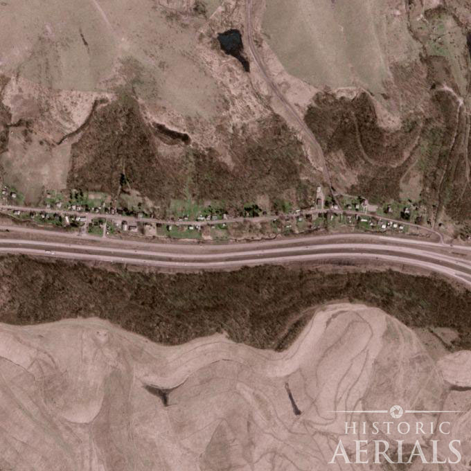
Historic aerial imagery makes these layered generations unmistakable. In places like the crossing of the Youghiogheny River at Somerfield, Pennsylvania, multiple versions of the road appear at once: an early, winding approach hugging the terrain; a later realignment cutting a cleaner path; and a modern bypass carrying traffic past the original crossing altogether.
From above, the landscape reveals not a single road, but a record of trial, correction, and improvement—each generation leaving its mark as expectations for speed, safety, and efficiency evolved.
In 1926, it became part of U.S. Route 40, known as the Main Street of America. Later, interstates like I-68 and I-70 closely followed its alignment, sometimes running just yards from the original route.
If you’ve ever noticed exits labeled National Pike, you’ve seen its legacy firsthand.
Beneath modern asphalt and concrete, the bones of America’s first highway remain.
So Maybe Your Commute Isn’t So Bad
The next time traffic slows or a delay tests your patience, imagine freeing a wooden wheel from knee-deep mud on a rain-soaked grade. Then take a sip of your coffee, turn up the music, and remember that every mile you travel rests on generations who refused to stay disconnected.
You’re not just driving to work.
You’re riding the idea that made the country whole.