Suburbs have become woven into the fabric of American life, stretching out from city centers and transforming what was once forest and farmland into sprawling neighborhoods, shopping centers, and winding cul-de-sacs.
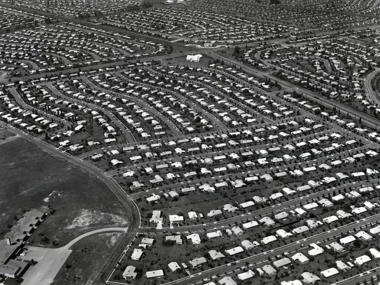
While suburbs might lack the historic landmarks that are common in cities—like old Main Streets, century-old churches, and grand mansions—each suburb has its own unique story to tell. Aerial photos are a powerful tool for uncovering these stories, revealing the gradual but impactful changes that have shaped suburban landscapes over time.
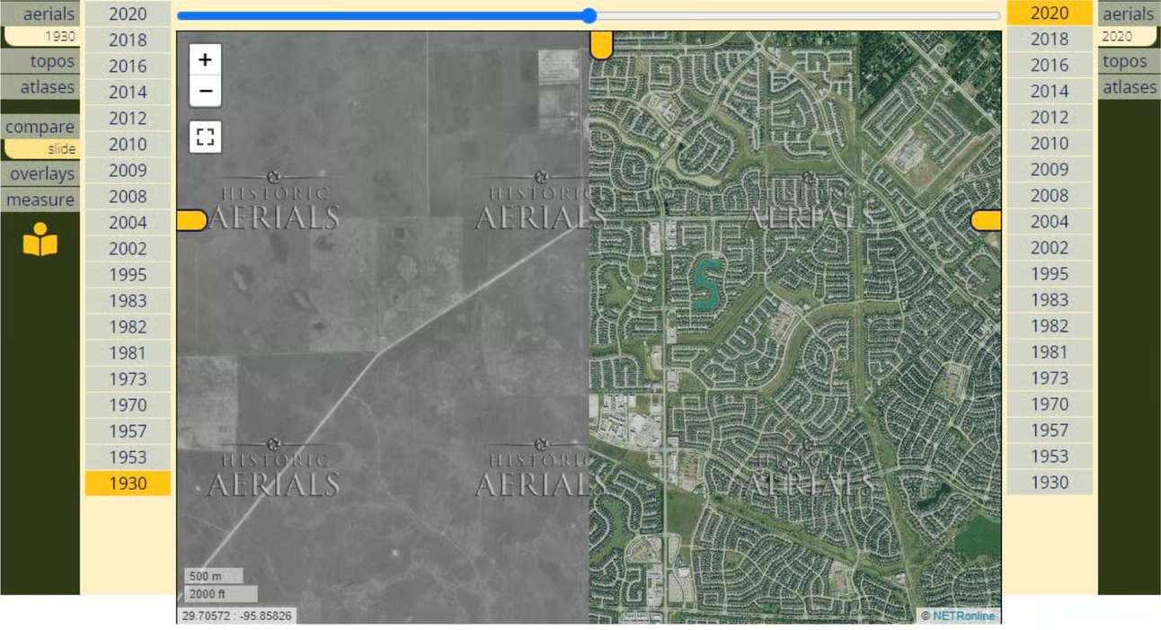
Whether you’re curious about the history of your neighborhood or researching the development of suburban areas, aerial photos are an invaluable resource. The oldest images available on HistoricAerials often show suburbs in their pre-development phase. By browsing chronologically through years of imagery, you can witness the dynamic evolution of these areas.
Atascocita, Texas: A Case Study in Suburban Expansion
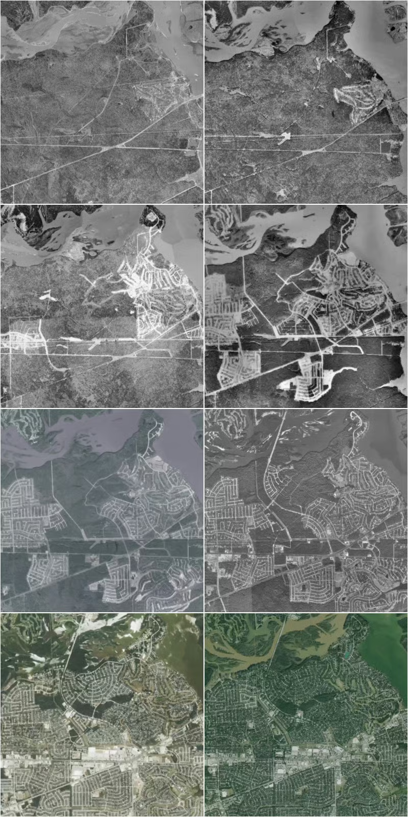
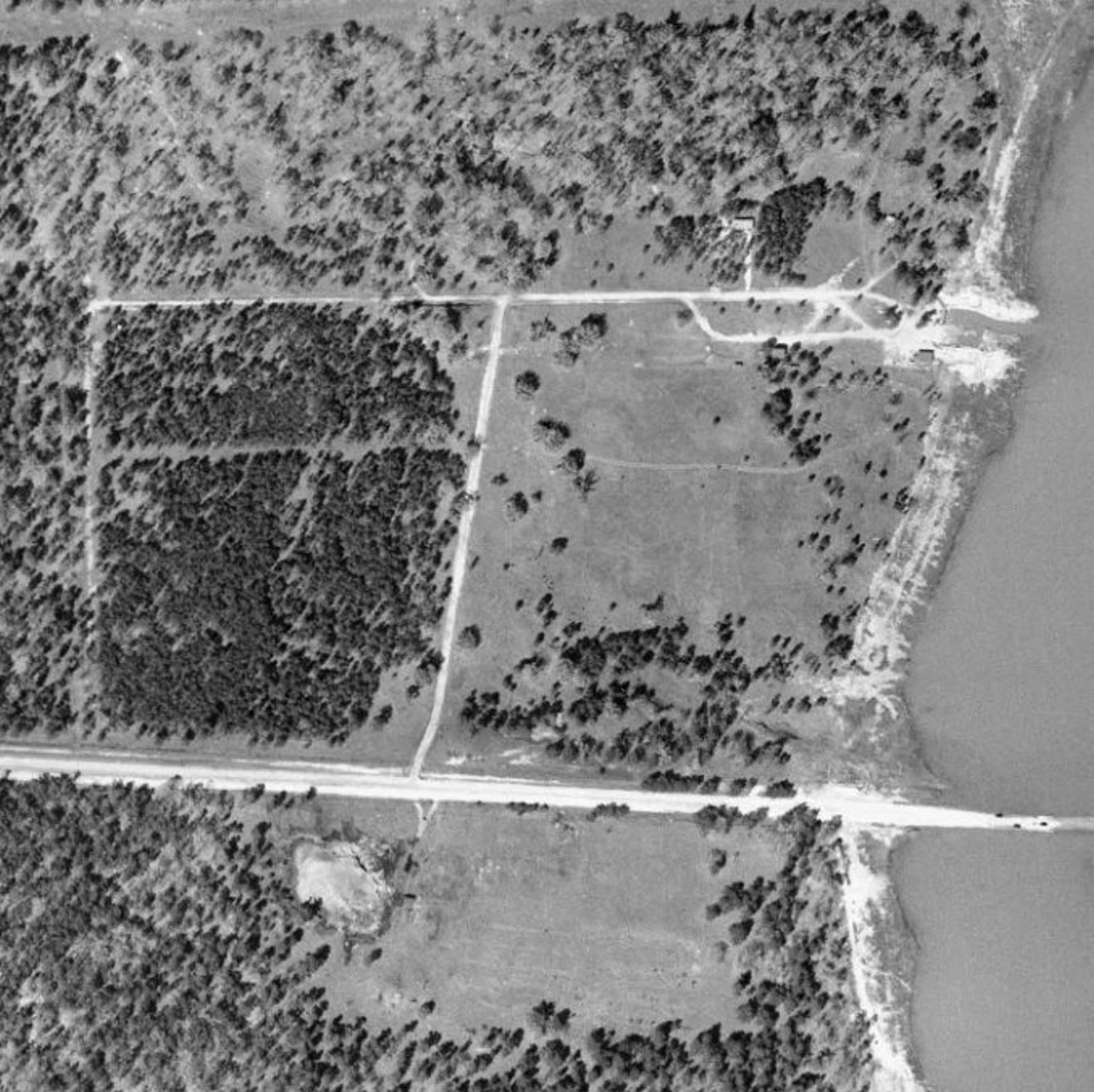
Take Atascocita, a suburb of Houston. In 1930, Edgar Tobin captured this area in aerial photographs As the photos show, the area was mostly dense forest back then. The historic Atascocita Road stands out, leading to the San Jacinto River at Atascocita Crossing. A ferry once operated there, along a significant 18th-century military and smuggling route, but by this time a bridge had been built.
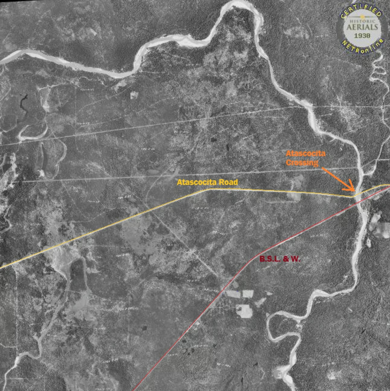
This crossing was eventually submerged when a dam was built to create Lake Houston. That 1930 image captures a moment just before this entire area changed—when the construction of the Lake Houston dam submerged the crossing and transformed the surrounding landscape.
In many places, aerial photos can allow you to pinpoint the very first neighborhood to be developed in a suburb, or even the very first street. In Atascocita, imagery from 1957 shows the first residential street, called Camp Lillie Road. Notably, nearly two decades passed before additional residential development followed.
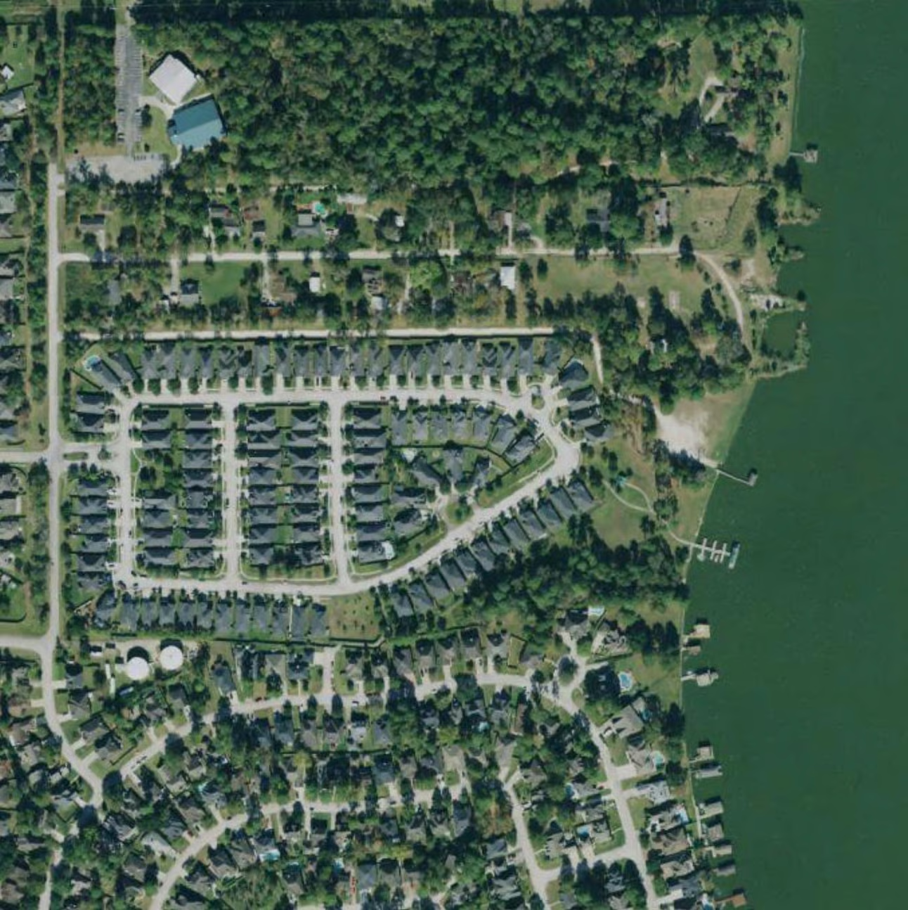
By comparing images from different decades, you can track the growth of an area, from the initial street layouts to the construction of homes and the eventual maturity of the neighborhood.
Whether you’re researching suburban sprawl, early neighborhood development, or the changing shape of your hometown, historic aerial photography is one of the most powerful tools available. Aerial imagery allows you to piece together the story of your community, frame by frame.