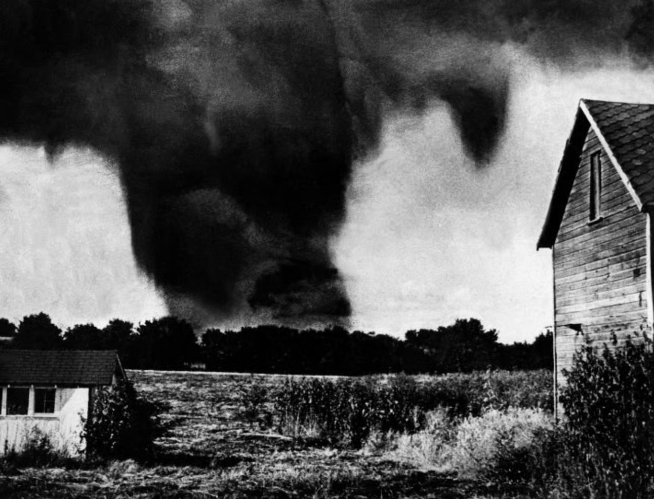
On the evening of May 20, 1957, a wedge tornado more than a mile wide carved through the Ruskin Heights neighborhood of Kansas City, Missouri. It killed 44 people. Injured over 500. Leveled Ruskin High School — a building that had anchored that community for years — in under a minute. When it was over, the neighborhood looked like something had reached down and erased it.
You can still see exactly where.
The image that stopped the scroll
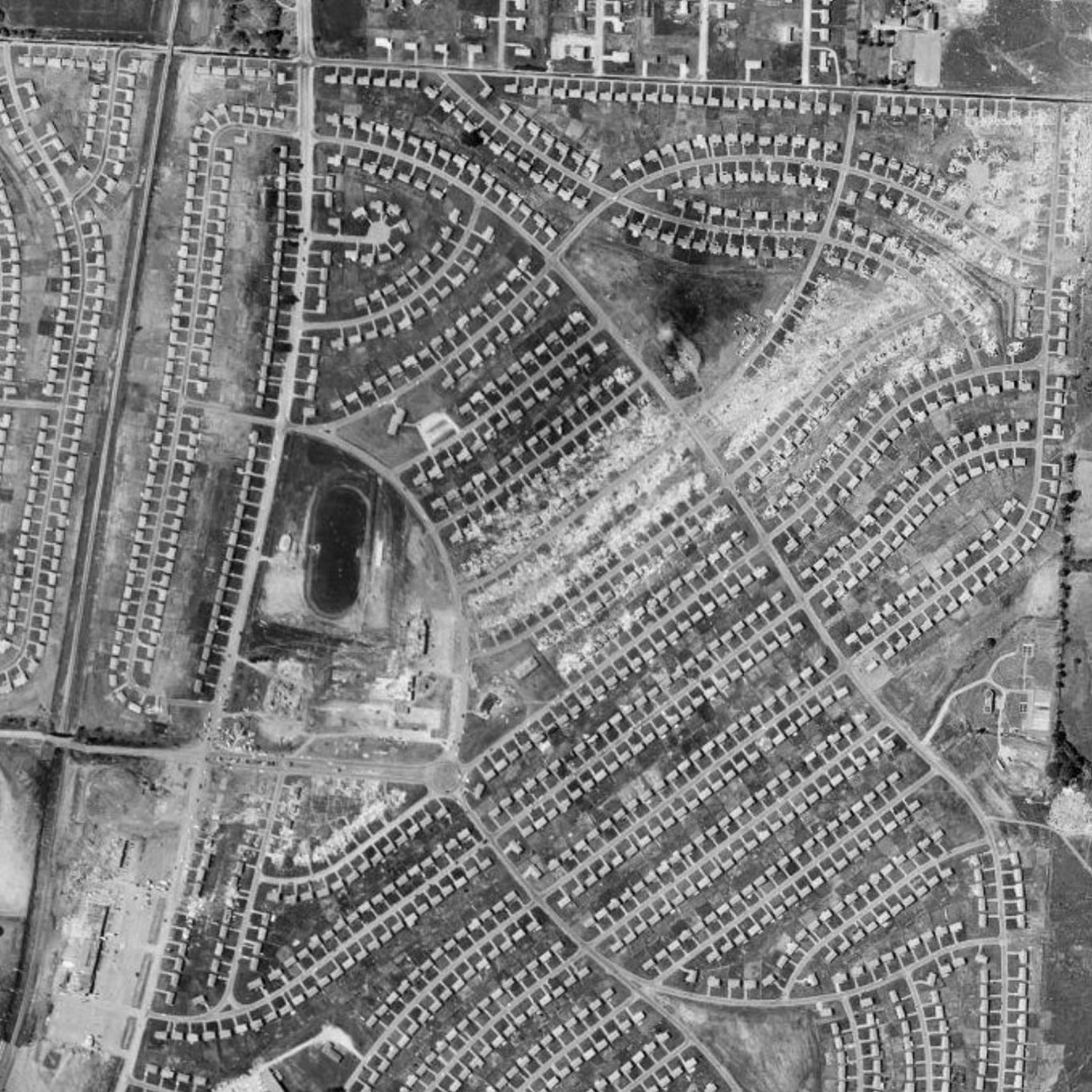
That’s what stopped Reddit user u/InheritTheWind4060 mid-scroll. They’d found a 1957 aerial image on Historic Aerials and posted it to r/tornado. The response made sense: the image is striking. The tornado’s path cuts through the Ruskin Heights subdivision like a scar that refuses to fade, every flattened block still legible from above. Sixty-seven years later, the geometry of that destruction is still readable.
This is what aerial photography does that nothing else can. The tornado itself is long gone. The sound of it, the chaos, the minute-by-minute terror; none of that is recoverable. But the path is. Aerial imagery freezes the aftermath at a resolution that ground-level photography simply can’t match. You see the whole shape of it. The width. The reach. The way it moved through streets and yards with indifference to everything in its way.
A disaster that changed how America watches the sky
The Ruskin Heights tornado was part of a larger outbreak that day, tracking 71 miles across the region. The damage it left behind wasn’t just physical. It exposed serious gaps in how Americans were warned about severe weather. In the years following, the disaster directly accelerated investment in better radar systems and more coordinated public alert infrastructure. Those changes have since saved countless lives. There’s a grim irony in that. The worst day Ruskin Heights ever had quietly made other communities safer.
Looking at the aerial image now, that history is compressed into a single frame. The cleared lots. The missing rooflines. The scar running through what had been, just hours before that image was taken, a functioning neighborhood full of ordinary life. Someone on Reddit found it and shared it, and people responded, because that kind of image does something to you. It makes the abstract real. Statistics about tornadoes don’t land the way a bird’s-eye view of the aftermath does.
History from above
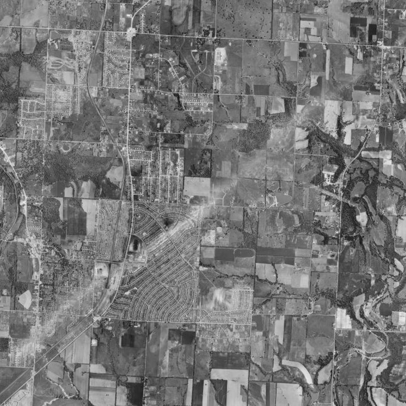
Historic Aerials holds thousands of images like this one — moments when the landscape was still raw, still telling the story before time softened it. Browse the archive long enough and you start to see history differently. Not as dates and summaries, but as places. Shapes. Scars.