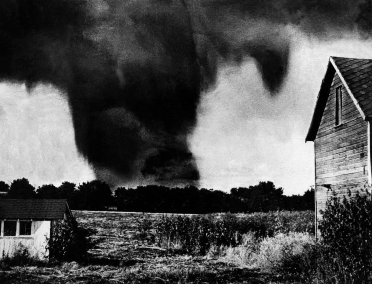
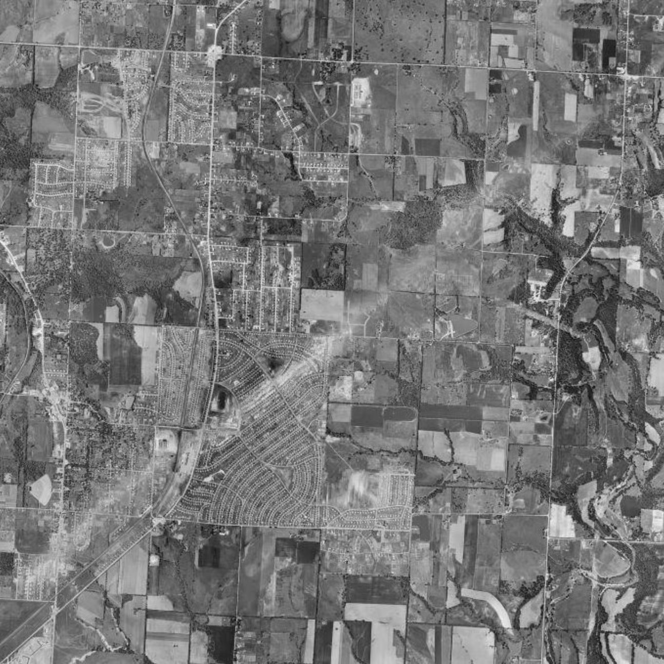
In May 1957, an F5 tornado tore through the Ruskin Heights neighborhood of Kansas City, Missouri, leaving 44 dead, over 500 injured, and a path of destruction that reshaped the landscape. Recently, Reddit user InheritTheWind4060 posted a 1957 aerial image from HistoricAerials.com on the subreddit r/tornado, which captures the aftermath of this disaster. The stark, scarred path of the tornado is clearly visible in the image, offering a haunting glimpse of one of the most devastating tornadoes in Missouri’s history.
The Ruskin Heights tornado was part of a larger outbreak and carved a 71-mile-long path through homes, schools, and businesses. Its mile-wide track flattened neighborhoods, and the damage led to significant improvements in tornado warning systems across the U.S.
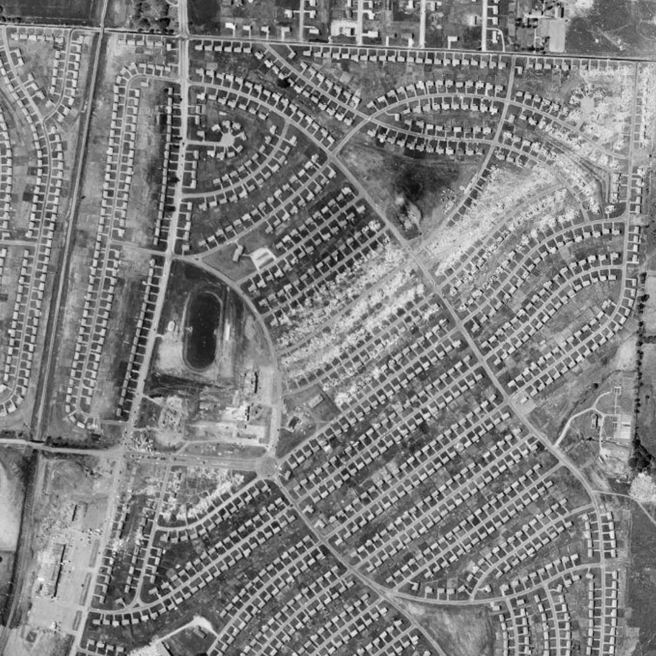
The aerial image posted on Reddit highlights the unique way HistoricAerials allows us to visually explore historical events like the Ruskin Heights tornado. Such images offer a valuable, bird’s-eye perspective on the destruction and impact, helping us better understand these natural disasters’ scope and their lasting effects on communities.
Historic aerial imagery offers a way to rediscover significant moments in history from above and connects us to the past in a powerful way. Visit HistoricAerials.com to explore more historic events and uncover the stories beneath the surface.