When the Union Army Balloon Corps quietly folded in 1863, military ballooning didn’t disappear. It migrated.
Within a few years, two veteran American aeronauts—James and Ezra Allen—had carried their experience into a very different conflict: the Paraguayan War (1864–1870), widely regarded as the deadliest interstate war in South American history.
For readers interested in aerial imagery, this moment matters. The Allen brothers’ work over the Fortress of Humaitá represents the first documented use of balloons for military reconnaissance in South America and produced some of the earliest true “bird’s‑eye” views of a battlefield on the continent (summarized in detail by historian Thomas Whigham).
From Virginia to Humaitá: The Allen Brothers’ Apprenticeship
By the end of the American Civil War, the Allens were among the most experienced balloonists in the United States. James Allen, a Rhode Island aeronaut active since the 1850s, had been flying balloons years before the war and quickly recognized their military potential.
During the conflict, James and Ezra Allen operated alongside — and at times in competition with — Thaddeus Lowe, John Wise, and John LaMountain, the small group of men who shaped America’s first experiments in military ballooning. Although Lowe ultimately secured formal command of the Union Army Balloon Corps, the Allens contributed reconnaissance ascents and technical expertise throughout the war.
When Lowe resigned in 1863 and the Balloon Corps unraveled, James Allen briefly assumed responsibility for remaining operations before the Army shut the program down entirely. What the Allens took from the experience was clear: balloons had proven their worth as intelligence platforms, even if military institutions struggled to support them.
The Deadliest War You’ve Never Heard Of
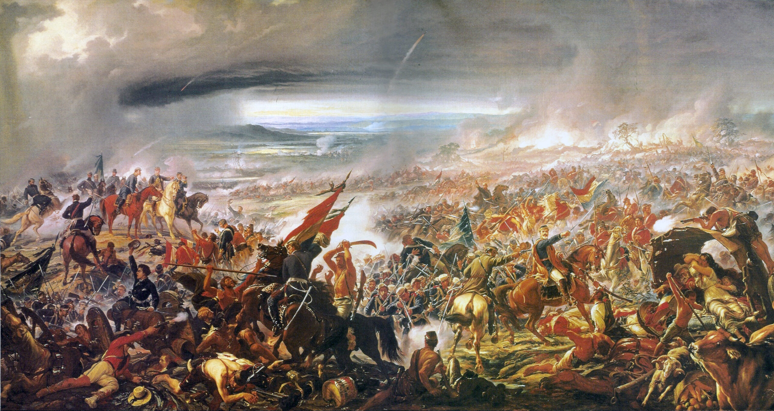
The Paraguayan War — also known as the War of the Triple Alliance — erupted in 1864 after Paraguayan leader Francisco Solano López launched attacks against Brazil and Argentina. What followed was a brutal six‑year conflict between Paraguay and a coalition of Brazil, Argentina, and Uruguay, fought across rivers, wetlands, and forested floodplains.
The scale of destruction was staggering. Modern historians estimate that Paraguay lost a substantial portion of its pre‑war population, leaving the country politically and economically shattered for generations.
For Brazil, the war demanded new approaches. The terrain was difficult to map, visibility was limited at ground level, and Paraguayan defenses exploited every natural barrier available. In this environment, aerial observation offered a rare strategic advantage.
Brazil’s Balloon Experiment
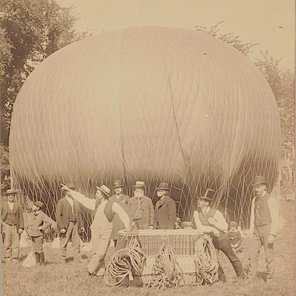
Brazil’s Emperor Pedro II, an enthusiastic patron of science and technology, authorized the recruitment of James and Ezra Allen in 1867 after reviewing reports of balloon reconnaissance during the American Civil War. The brothers arrived with practical knowledge of captive balloons and field gas generation techniques similar to those Lowe had pioneered in Virginia.
The Brazilian balloon detachment relied on hydrogen‑filled captive balloons, not hot‑air balloons. Hydrogen was produced in the field using iron and acid, allowing ascents without reliance on urban gas works — a crucial adaptation in the remote Paraguayan theater. Contemporary accounts describe teams of soldiers winching the balloon aloft while observers sketched the terrain below.
Operational constraints were significant. Shortages of materials limited balloon size, and only one of the two imported envelopes saw sustained use. Even so, approximately twenty ascents were conducted during the campaign, primarily in the vicinity of Humaitá.
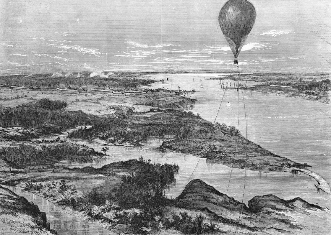
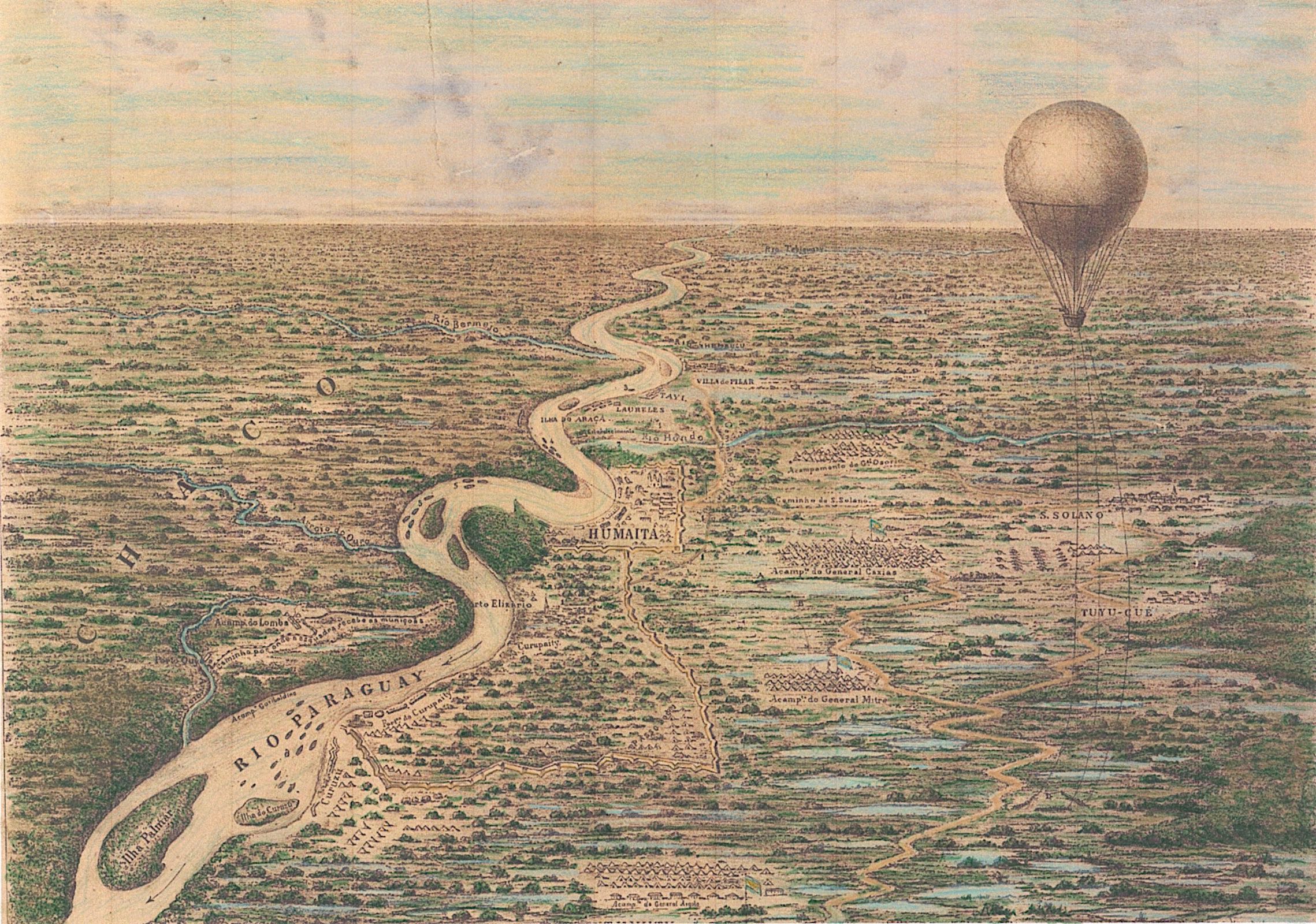
Seeing the Fortress from Above
The Fortress of Humaitá, positioned on a tight bend of the Paraguay River, formed the backbone of Paraguay’s river defenses. Its guns, mines, and boom chains made direct naval assault nearly impossible. From the ground, the surrounding marshes and tall grass concealed both Paraguayan positions and potential routes of advance.
From the balloon basket, however, observers could trace river channels, identify solid ground suitable for troop movement, and map Paraguayan fortifications with far greater accuracy than was possible from below. This information fed directly into Brazilian planning under Marquis of Caxias, enabling a flanking maneuver that eventually rendered Humaitá untenable.
The results were not instantaneous, but the fall of Humaitá in 1868 marked a decisive turning point. Paraguay continued fighting for two more years, but its strategic position was irreversibly compromised.
Bird’s‑Eye Views Without Cameras
One of the most enduring artifacts of the Allen brothers’ work is an 1868 Harper’s Weekly engraving titled Bird’s‑Eye View of Fort Humaitá, Paraguay (Taken from Allen’s Balloon). Although often mistaken for an early aerial photograph, the image is a carefully constructed illustration based on sketches and measurements gathered during balloon ascents.
This was aerial intelligence without aerial photography. The limitations of wet‑plate photography — heavy glass negatives, long exposure times, and the need for an immediate darkroom — made routine balloon photography impractical in the field. Instead, the Allens produced maps and visualizations that functioned much like modern oblique aerial imagery, translating a vertical perspective into a usable strategic picture.
Why the Technology Still Fell Short
Despite earlier successes by Nadar in France and James Wallace Black over Boston, aerial photography remained largely incompatible with battlefield ballooning in the 1860s. Captive balloons swayed unpredictably, chemical processes were fragile, and tropical conditions further complicated matters. The result, once again, was reconnaissance without photographs.
It would take the later adoption of dry‑plate photography, faster shutters, and ultimately powered flight before aerial photography could become a routine military tool.
Reading Humaitá from the Air Today
Modern aerial and satellite imagery reveals the enduring logic of Humaitá’s geography. The river bend, floodplain, and surrounding high ground remain legible from above, allowing today’s analysts to see exactly why the fortress dominated the campaign. In this sense, contemporary aerial imagery fulfills the promise the Allens could only approximate with sketches and notes.
Setting the Stage for Part III
The Paraguayan War demonstrated that balloon reconnaissance was not a uniquely American experiment. It could be exported, adapted, and integrated into other military traditions. European observers took notice.
In Part III of Balloons of War, the story crosses the Atlantic once more, as British officers begin experimenting with balloon sections during imperial campaigns — a critical step toward the systematic military aerial photography that would emerge by the early twentieth century.