The story of commercialized aerial photography in the United States is incomplete without mentioning Edgar Gardner Tobin, a pioneering figure whose work in the 1930s laid the groundwork for modern aerial surveys. Born in San Antonio, Texas, Tobin was a decorated World War I fighter pilot before venturing into the burgeoning field of aerial photography. The upcoming HistoricAerials documentary, Through the Lens, delves deeper into Tobin’s life and career, but here I want to talk about his aerial surveys that would make up the Edgar Tobin Aerial Surveys of East Texas Collection, 1930s.
From Battlefields to Oilfields
After the war, Tobin returned to Texas and initially worked as an auto dealer. His interest in aviation remained strong, and by 1928, he had established Edgar Tobin Aerial Surveys in San Antonio. His company quickly became the largest aerial mapping firm in the world, providing invaluable services to various sectors, particularly the oil industry.
These surveys provided a bird’s-eye view of the landscape before the extensive development of modern highways and other infrastructure.
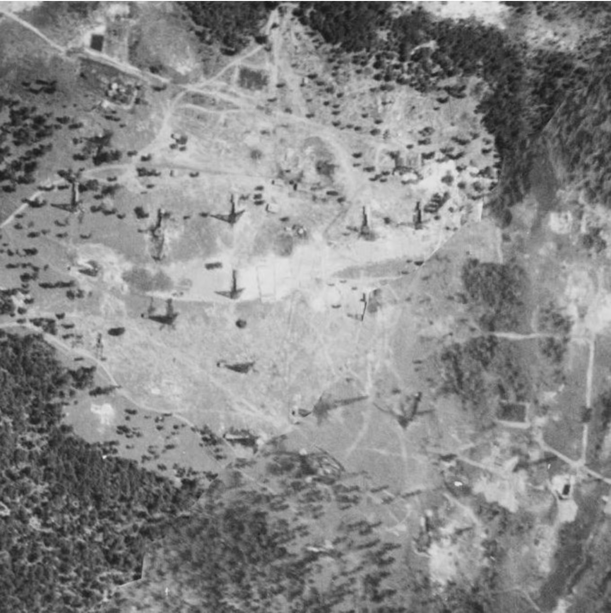
Tobin’s aerial surveys in the 1930s primarily served the needs of oil companies, such as the Humble Oil and Refining Company (which later merged with Exxon). These companies required detailed aerial maps to identify and manage oil fields, plan pipelines, and oversee the development of oil infrastructure. Tobin’s work included mapping extensive tracts of land in East Texas, capturing images of oil and gas wells, cities, towns, railroad lines, canals, and other key features essential to the industry.
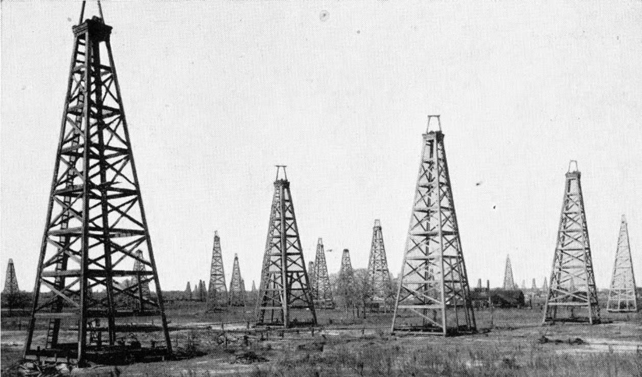
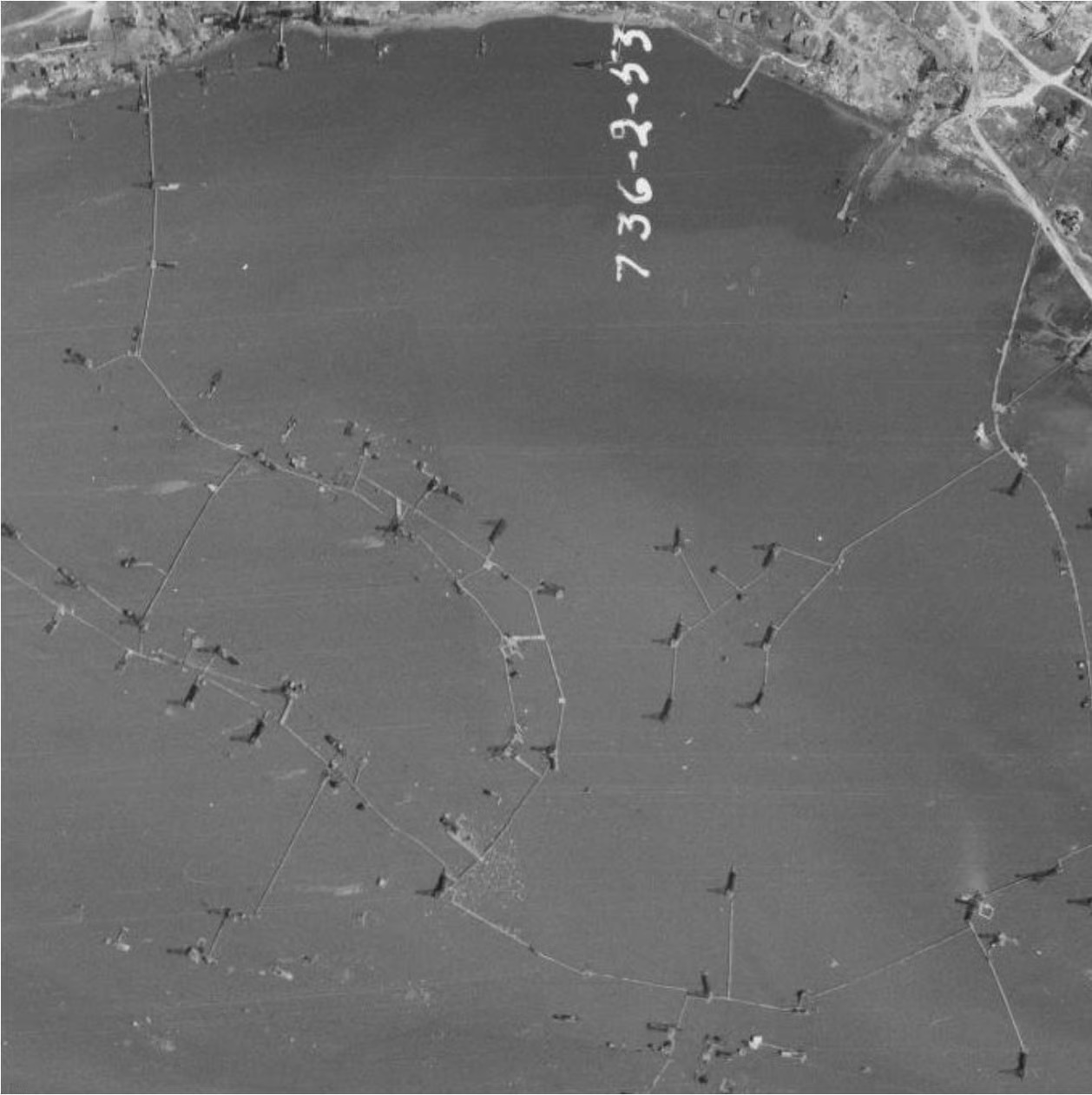
One notable project was the mapping of the Humble oilfield, one of Texas’s earliest and most significant oilfields. Beyond this, Tobin’s aerial photographs covered other crucial sites, such as Goose Creek and Conroe oilfields. Let me share with you a few of the aerial images of a couple of these sites in which details like oil derricks and storage tanks.
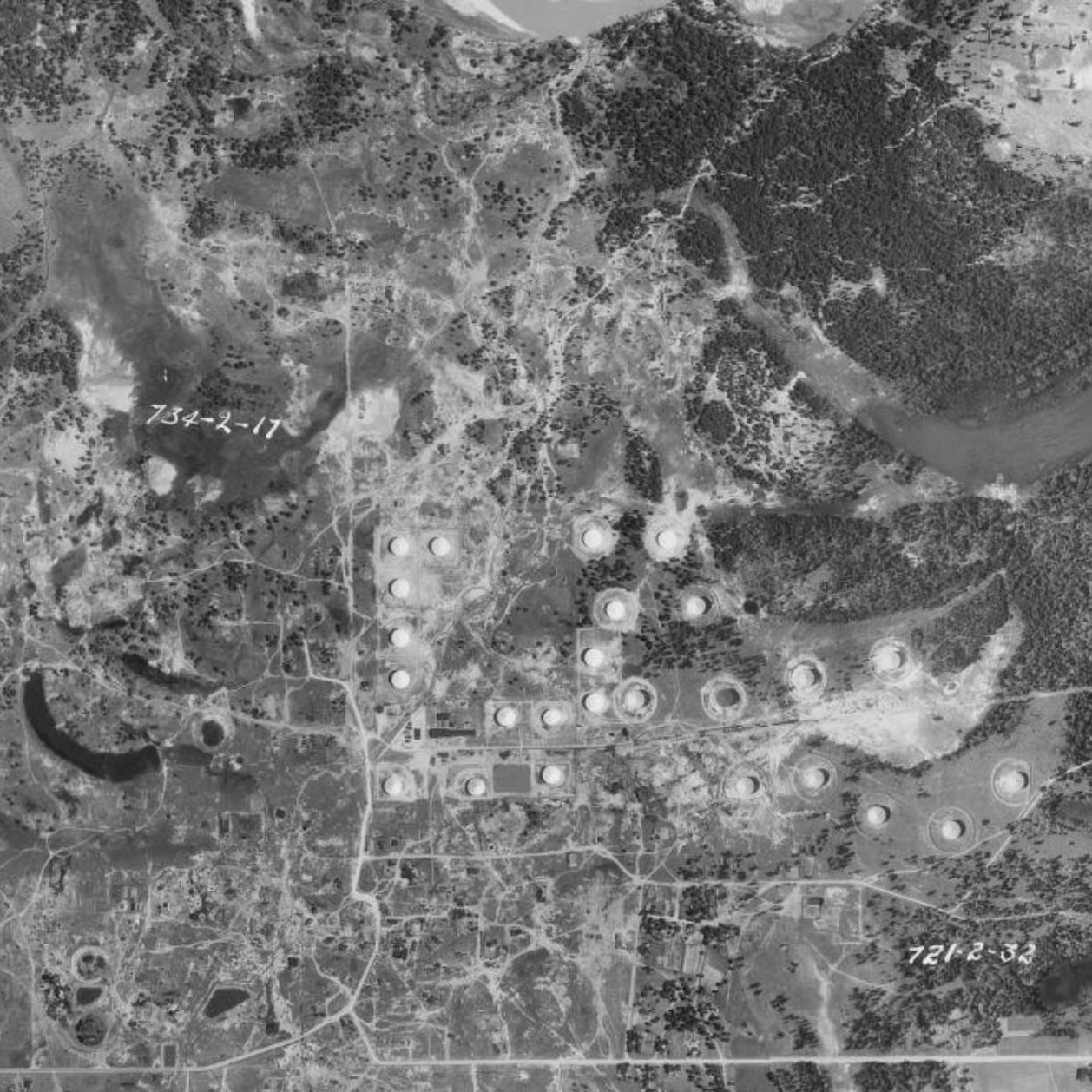
The Humble Oilfield
Located in Humble, Texas – which happens to be this writer’s hometown – the Humble oilfield was one of the state’s earliest and most significant oil discoveries. The field was discovered in 1904 and experienced rapid development, quickly becoming one of the leading oil-producing areas in the state. By 1930, it had established itself as a prolific producer, contributing substantially to Texas’s burgeoning oil industry.
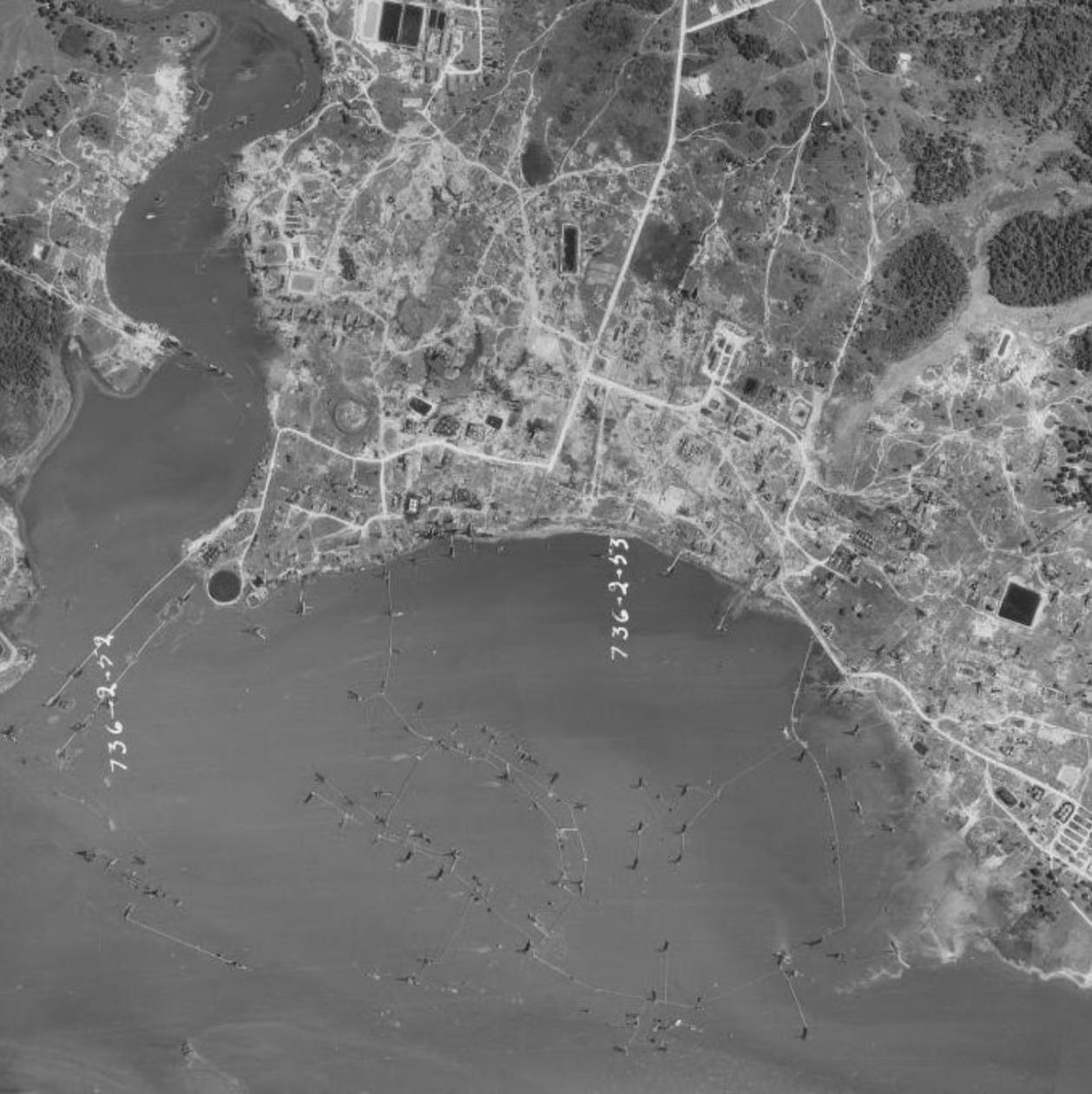
The Goose Creek Oilfield
The Goose Creek oilfield, located in Baytown, Texas, near the banks of Galveston Bay, was another one of the pioneering sites of Texas’s early oil boom. Discovered in 1903, the field quickly gained prominence for its significant oil reserves and groundbreaking developments in offshore drilling. By 1917, Goose Creek was producing substantial quantities of oil, solidifying its role in the burgeoning petroleum industry.
Goose Creek was notable for being the site of the first offshore drilling in Texas – and only the second in the United States – with rigs built on platforms extending into the bay. This innovation set a precedent for future offshore oil exploration.
Remarkably, Tobin’s photographs from the 1930s represent the bulk of the earliest aerial photographs available. These surveys provided a bird’s-eye view of the landscape before the extensive development of modern highways and other infrastructure, preserving a snapshot of the region’s early industrial era.
The introduction of aerial photography represented a significant technological leap for the oil industry. Tobin’s surveys allowed for more efficient exploration and management of resources, leading to increased productivity and safety. The detailed aerial images helped oil companies make informed decisions about drilling sites, pipeline routes, and other logistical aspects of oil production.
During World War II, Edgar Tobin’s expertise in aerial photography became crucial to the war effort. He served as a special civilian aide to General Henry “Hap” Arnold of the United States Army Air Forces. In this role, Tobin was instrumental in the mapping of invasion routes, which significantly contributed to the success of Allied operations. His company, Edgar Tobin Aerial Surveys, mapped the entire United States for the federal government during the war, providing vital geographic information that supported military strategy and planning.
Edgar Tobin’s contributions to aerial photography extended beyond his lifetime, influencing modern mapping techniques and the use of aerial imagery in various industries. Today, platforms like HistoricAerials offer a chance to explore Tobin’s pioneering work and appreciate the technological advancements that followed.
As HistoricAerials prepares to release a documentary discussing Tobin’s life and work, there has never been a better time to delve into the rich archive of his 1930s aerial photographs. To truly appreciate the impact of Edgar Tobin’s work, we invite you to explore the extensive collection of his aerial photographs available on HistoricAerials.