There’s a certain poetry to seeing the past from above. The faint outline of a gravel lot, the ghost of a screen’s shadow, the looping pattern of old car ramps. All the remnants of a once-vibrant drive-in theater now swallowed by suburbs or sagebrush. For historians like Michael Kilgore, those traces are more than curiosities; they’re coordinates on a map of American memory.
Michael Kilgore is an author and passionate historian of drive-in theaters. In the past five years, he’s published several books about them: Drive-Ins of Colorado, Drive-Ins of New Mexico, and Drive-Ins of Route 66: Expanded Second Edition. For each of these books, he utilized aerial imagery and topographic maps from HistoricAerials to help tell the stories of this bygone era.
Discovering Drive-Ins Through the Lens of History
We had some questions for Michael about his process…
What initially sparked your interest in drive-in theaters and their history?
I grew up going to drive-in movies, and I took my future wife to drive-ins on dates. I spent a few years in Houston during the 1990s, a time when they didn’t have any active drive-ins nearby. So I appreciated them all the more when I moved to Colorado and started investigating where they were and how they had developed.
How did you discover HistoricAerials, and what role did it play in your research process?
I’ve been using HistoricAerials for so long that I don’t remember how I first found it. My primary use of HA has been to identify a drive-in’s exact former location. I’d read a note mentioning that it was west of town on Highway 64, then I would use HA’s topo maps and photos to quickly spot it.
Is there any specific instance where HistoricAerials helped you uncover something surprising about a drive-in theater?
HA excels at showing changes over time. One good example of a surprising change is the Tesuque Drive-In in Albuquerque. (See attachment image) The left photo, from 1951, two years after the drive-in opened, shows a small drive-in. The middle photo (1959) shows a wider drive-in, and in the right photo (1967), the screen had been rotated 45 degrees to point northeast. The 1959 photo suggested a small, second set of ramps with a screen pointing southwest, which helped me understand contemporary notes about the Tesuque’s “east screen,” abandoned after the 1956 season.
From Hearsay to Exact Locations: The Impact of Aerial Imagery
How has the availability of historical aerial imagery changed the way historians and authors can research and document cultural landmarks?
Aerial photos have changed the field of drive-in history by changing their sites from hearsay to exact locations. It’s especially helpful because memories can be faulty but photographic evidence typically settles questions. Along with newspaper stories and other primary sources, historical photos allow the stories of history of be told confidently.

What was the most fascinating drive-in theater story you uncovered during your research?
The drive-in war of Delta, Colorado, is the story worthy of a miniseries. There were two drive-ins almost across the street from each other. the Tru-Vu and the Skylite. Each was owned by a husband and wife. In 1958, the Tru-Vu was repeatedly vandalized, losing over 100 speakers and connectors in about a month. The following year, the Tru-Vu wife sold her interest in the Tru-Vu to the Skylite owners. Then, in1960, a teenager allegedly directed by the Skylite owners set a fire that gutted the Tru-Vu’s projection/concession building. The arsonist later confessed, then the Tru-Vu owners sued and earned a settlement just before trial was to begin in early 1962, ending up owning both drive-ins. Months later, the Tru-Vu owners divorced.
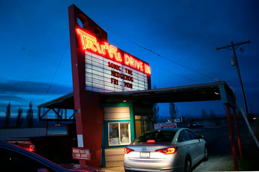
That’s an extremely condensed version of the story. and here’s a footnote: The Tru-Vu is still active today, and the Skylite, renamed the Big Sky, is pretty much intact, still a stone’s throw from its old rival.
What advice would you give to other authors or historians looking to use HistoricAerials in their own research projects?
Don’t overlook topo maps. Although they are trailing indicators, slower to update than actual photos, they sometimes therefore show “ghosts” of buildings where they once were. If you’re fortunate enough to be looking for features that topo maps typically call out, such as schools or drive-in theaters, they can be much easier to find in a topo than in a photo.
What motivated you to write three books on this specific topic in just five years?
I sort of did four. It surprised me to learn that no one had written about the drive-ins that had been along Route 66 – two nearly perfectly aligned pieces of American car culture history. The only way I was going to read that book was to write it. Then I turned to the many stories of the drive-ins in my adopted state of Colorado. With new information and better photos, I wrote a second edition of my Route 66 book. Finally, the folks in New Mexico were so amazingly helpful in my research that I put together everything I could find into Drive-Ins of New Mexico.
What’s next for you? Are you planning to continue documenting drive-in theaters in other regions or explore new topics?
I’ve been researching California drive-ins, but that book would be about three times as large as anything I’ve published. I’m not sure about that project. I’ve also begun writing “Drive-Ins: The Complete History (so far),” which I hope will be out in 2026.
Kilgore also added that he was “grateful to HistoricAerials.com” for allowing him to use “thumbnail photos” in his books, as well as in “presentations that I’ve given in historical societies.” We’re equally grateful that authors like Kilgore are able to use HistoricAerials to bring depth, accuracy, and visual storytelling to their work—transforming historical research into something readers can truly see.