A subdivision that stops halfway
From above, it looks like something went wrong. Streets form a clean grid. Curbs are in place. Streetlights stand at regular intervals. Houses line one side of the road. On the other, the lots remain empty, open ground where the rest of the neighborhood should be.
The boundary isn’t gradual. It’s precise. Development advances, then stops, following a shape that doesn’t match property lines or planning logic. It matches something older.
This is Humble, Texas, the location of one of the earliest oil fields in the United States. By the time formal environmental regulation existed, the land here had already been used, abandoned, and in some cases forgotten. What remains is not just the history of extraction, but the footprint of how it was handled.
To understand what stopped this neighborhood, you have to go back.
I filed it away as a curiosity. That is, until I discovered historic aerial imagery.
What the earlier imagery shows
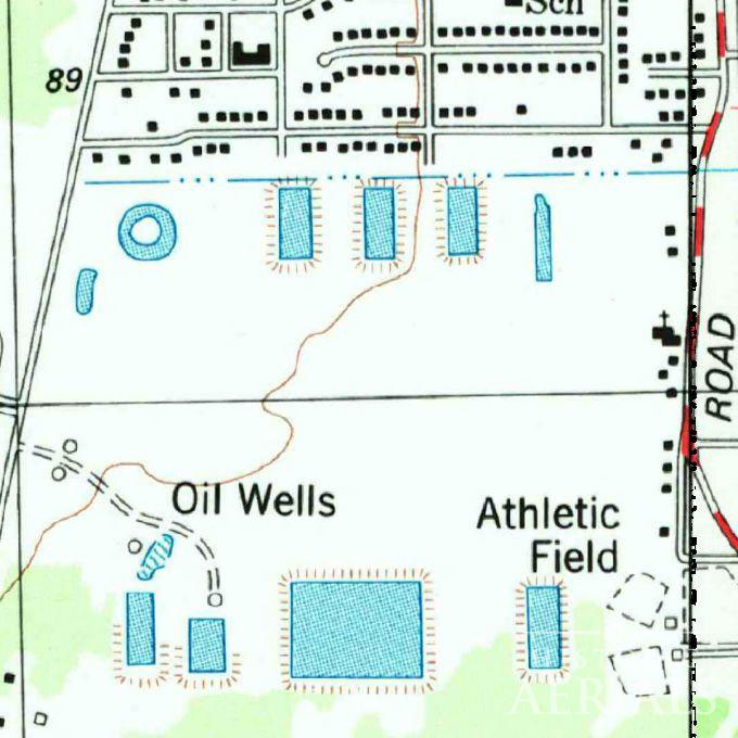
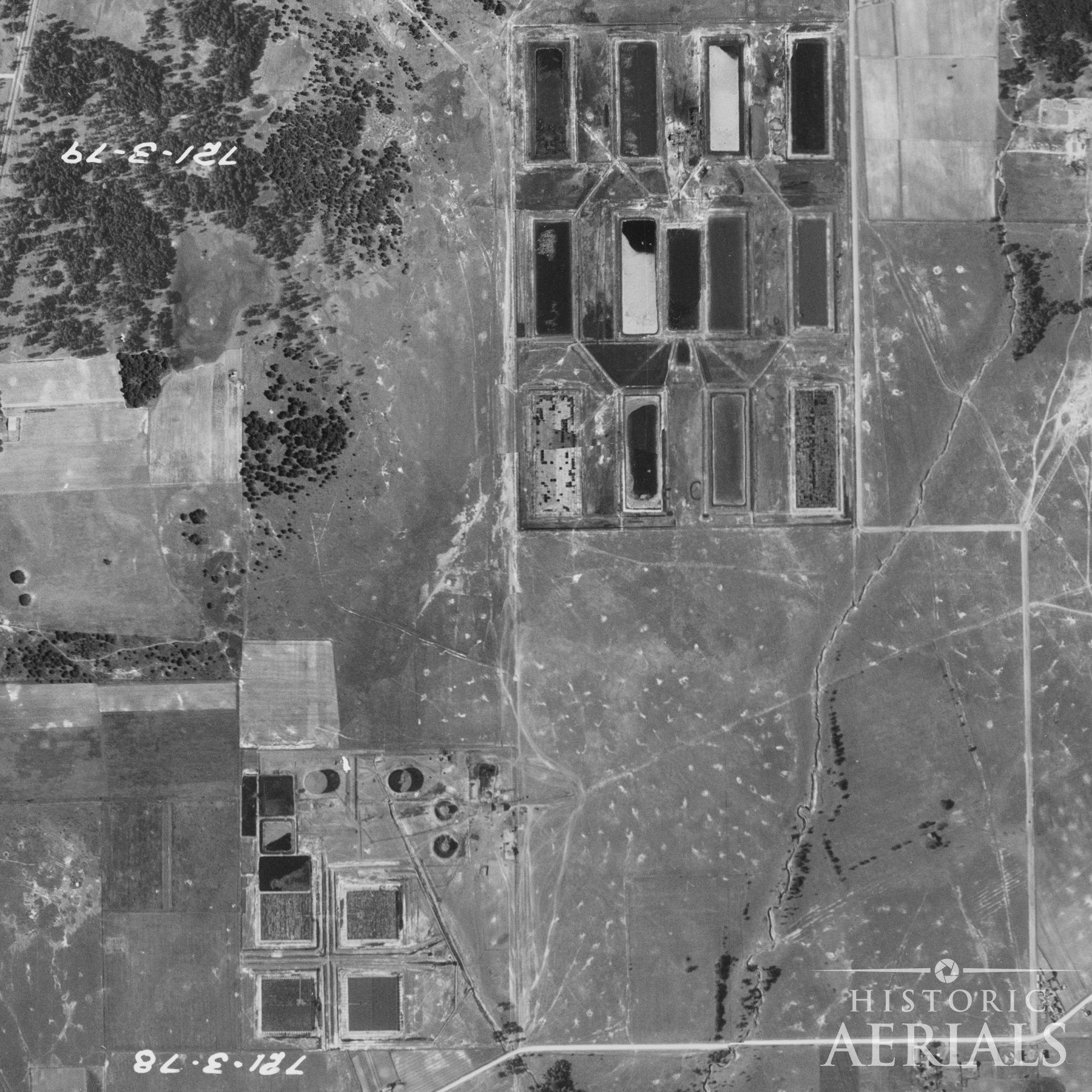
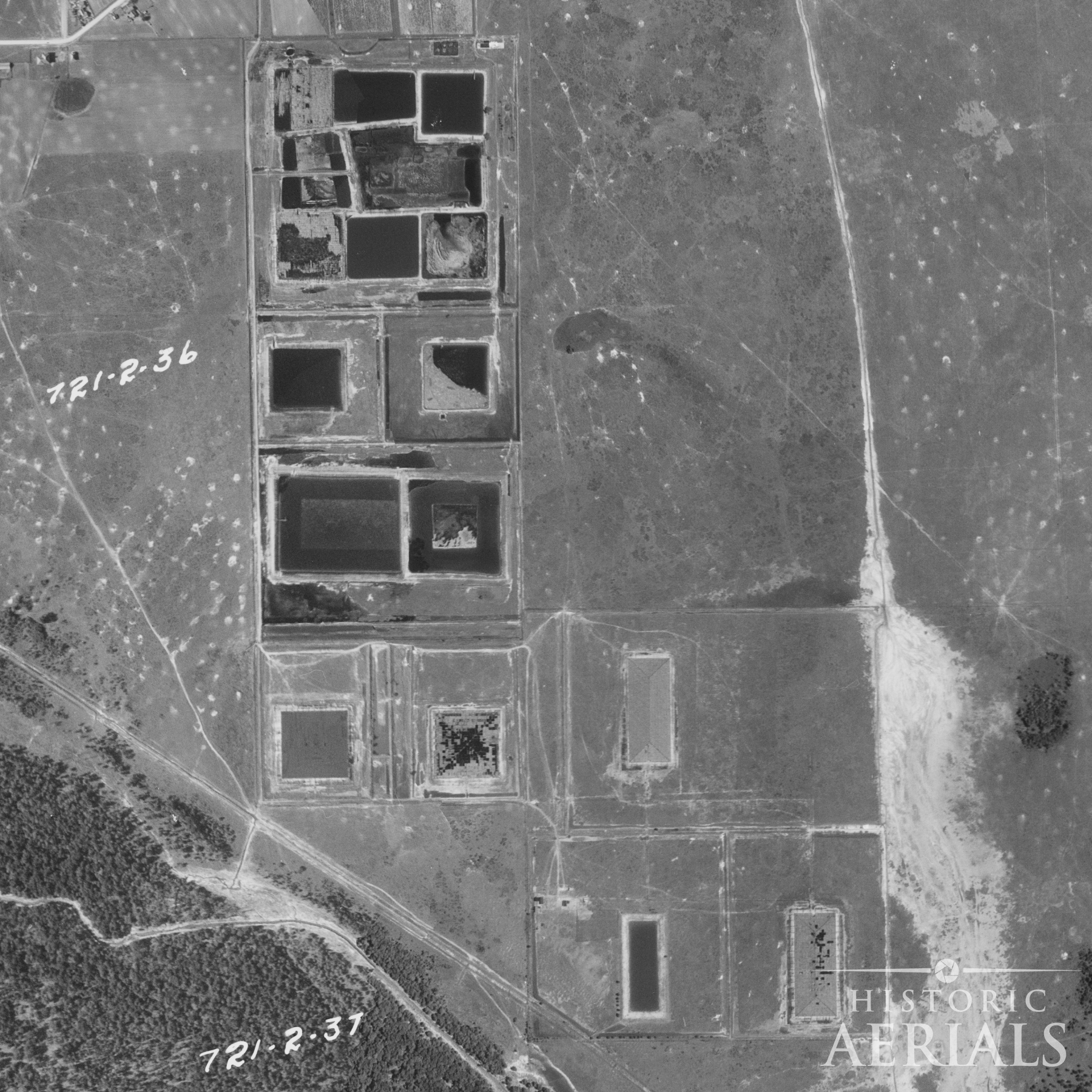
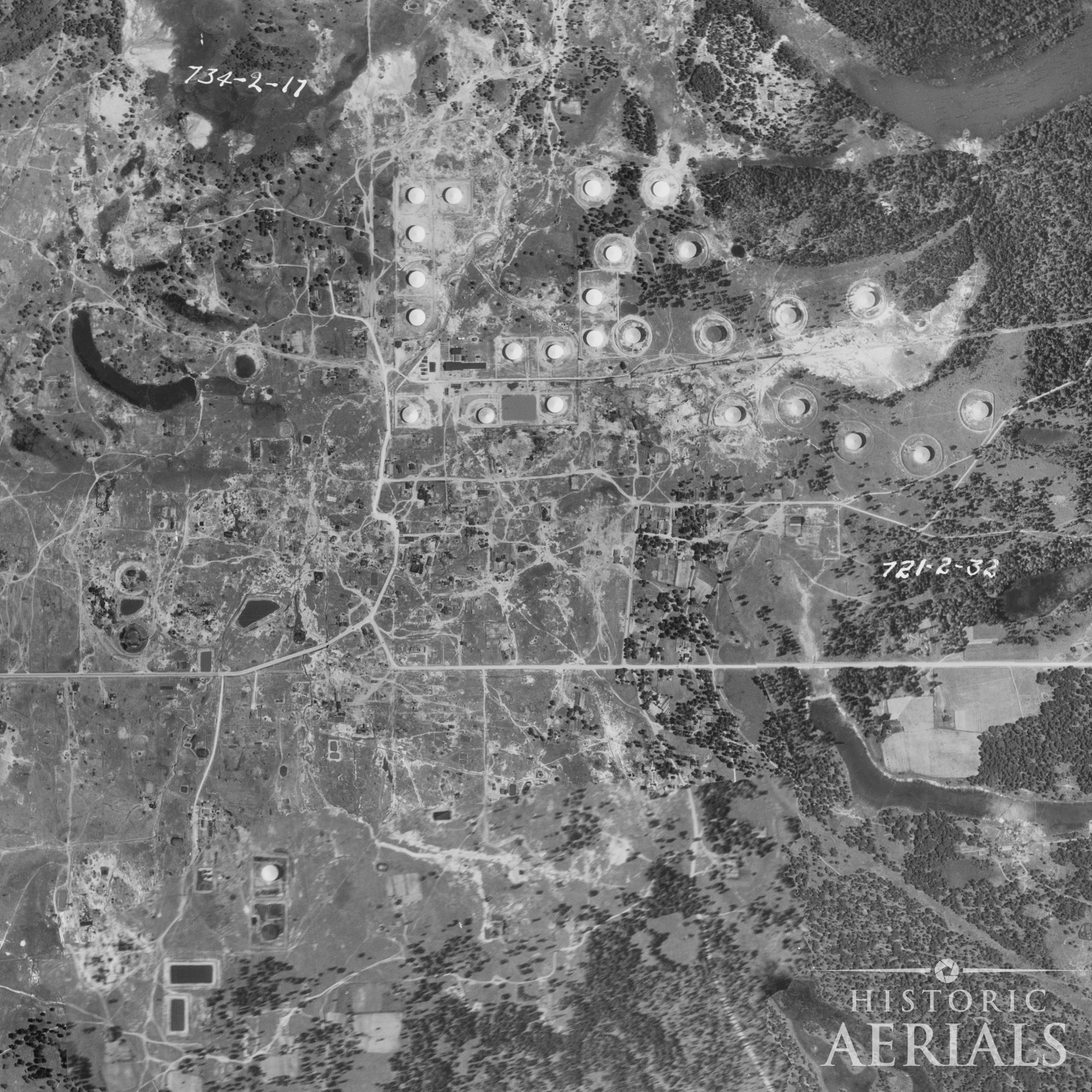
The 1930 aerial of the land that would later become Memorial Glen, between Old Humble Road and Wilson Road just north of Will Clayton Parkway, shows a very different landscape. Dark, rectangular features cut into the ground appear in clusters.
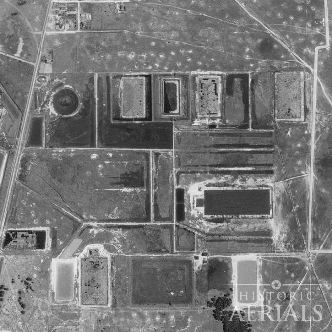
These were oil pits. Open, unlined earthen impoundments used to store crude and dispose of waste during Humble’s early oil boom.
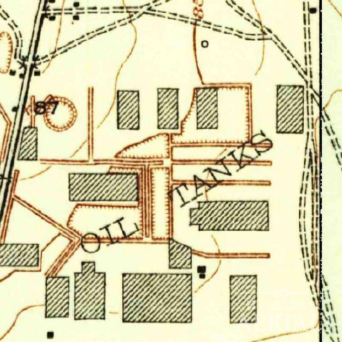
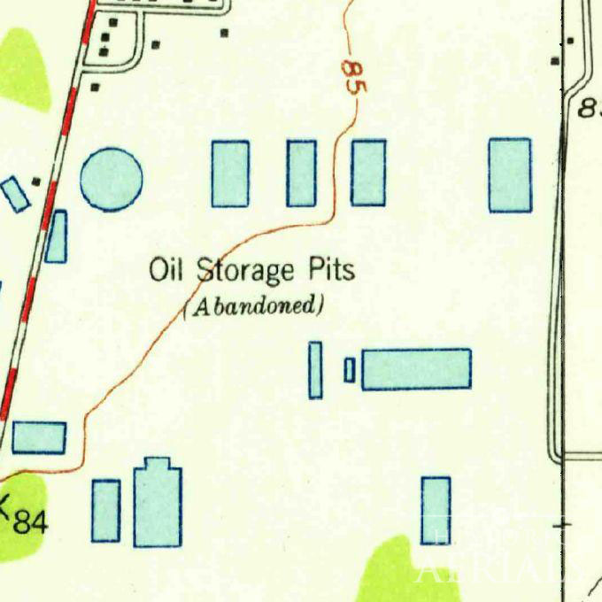
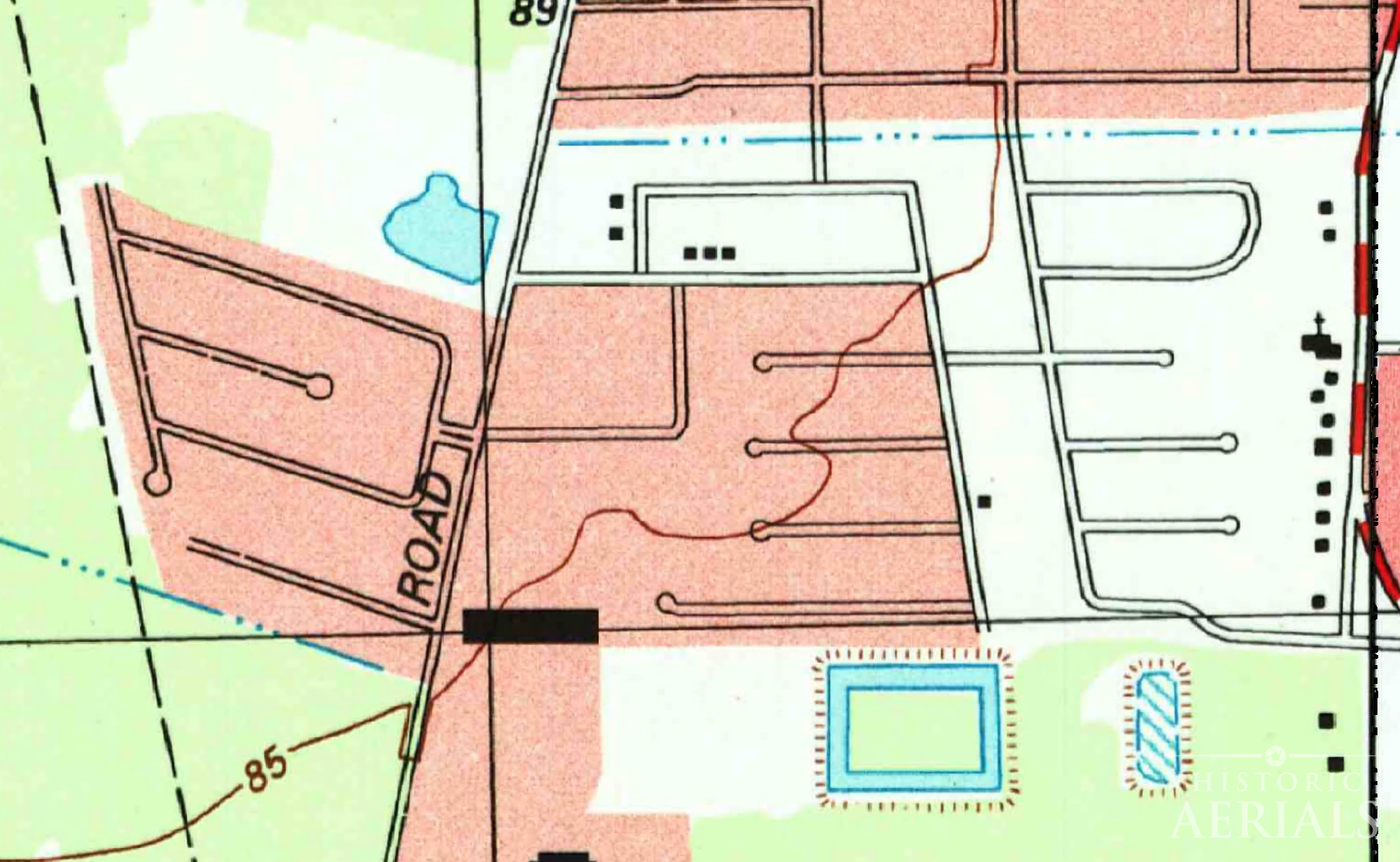
The 1933 USGS topographic map labels them plainly: Oil Tanks. By 1956, the language is more explicit: Oil Storage Pits (Abandoned).
Abandoned, but not removed
Through subsequent editions, the maps continue to acknowledge the site. Oil Wells appears in the 1967 and 1969 maps. By 1982, the same area is labeled Oil Wells and Athletic Field, even as residential development approaches from the north.
The surface changes. The underlying use does not disappear.
Building around the pits
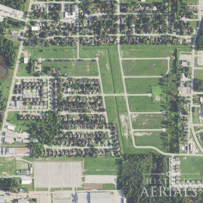
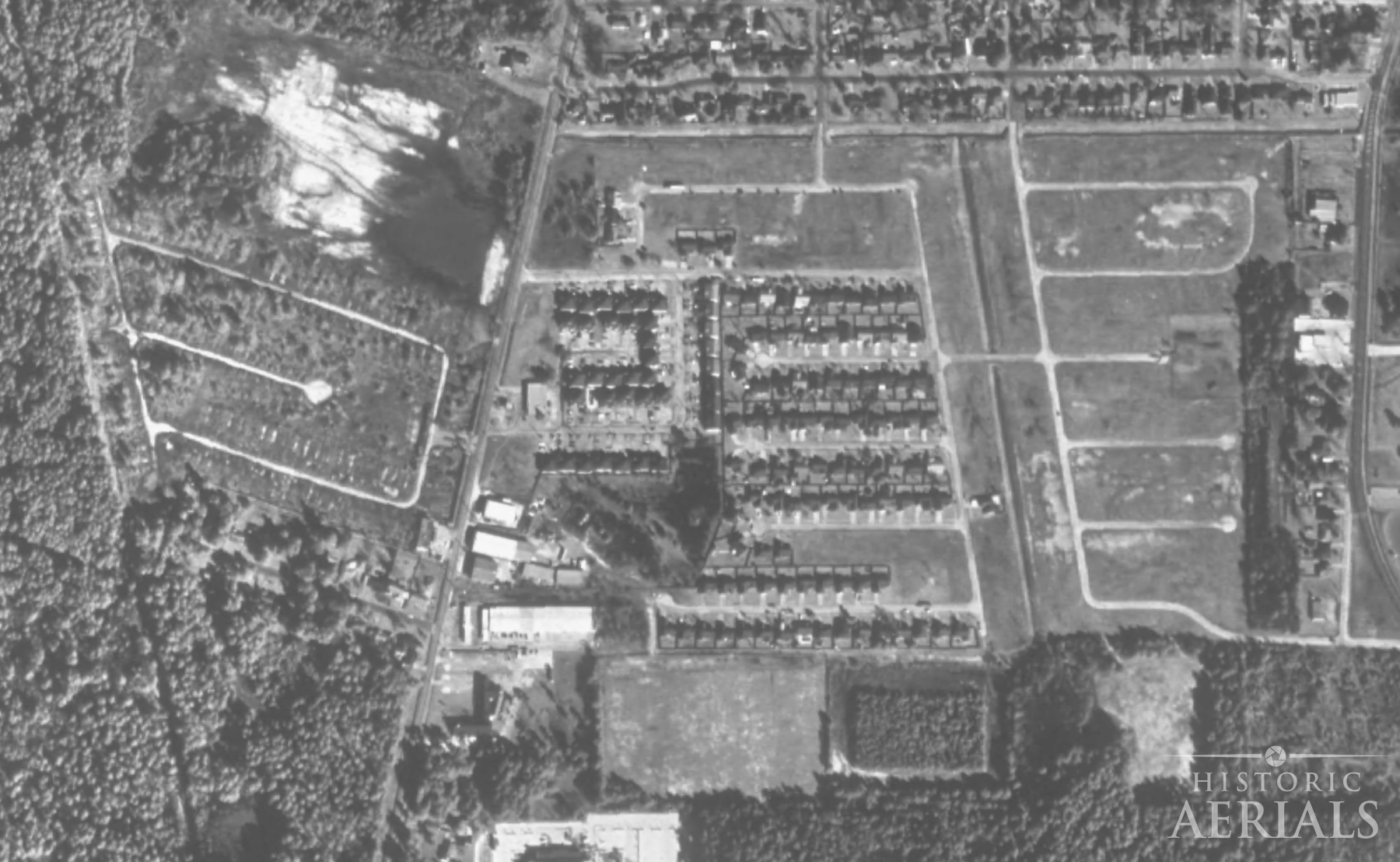
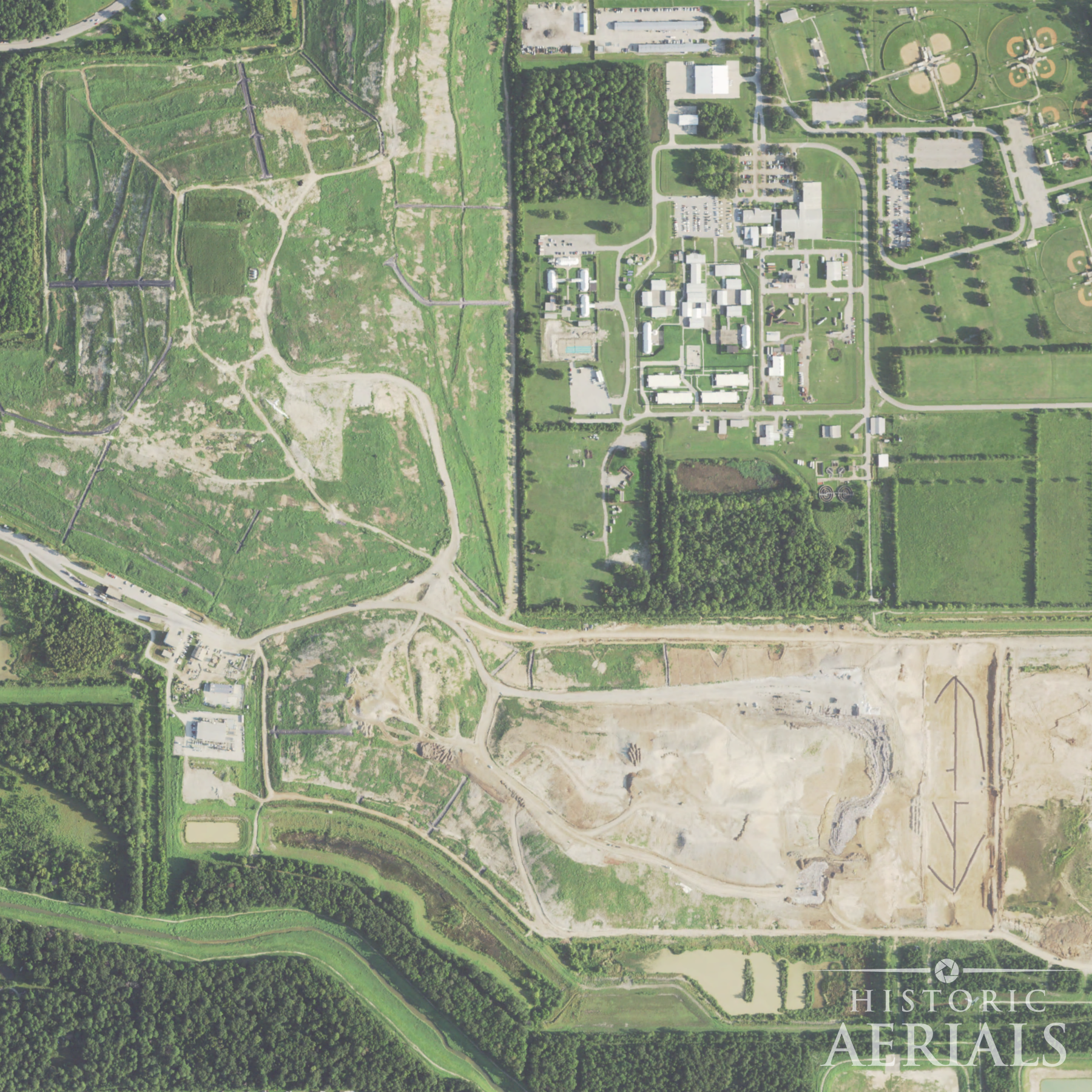
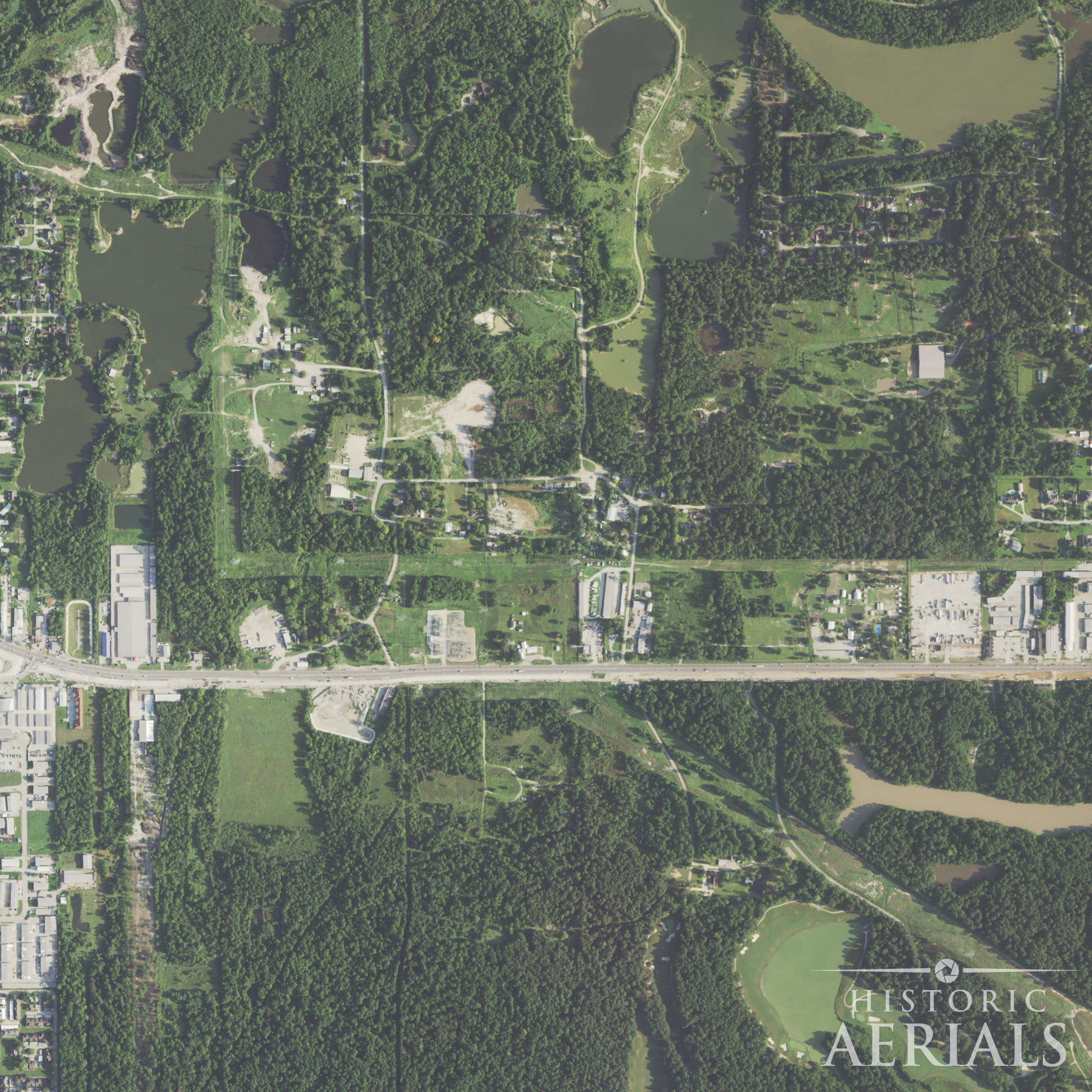
By 1981, aerial imagery shows streets graded and houses going up across what would become Memorial Glen. But the development is selective.
Homes appear along Thomas Lane and Meadow Glen Drive. Other streets remain empty, graded and curbed but never built out.
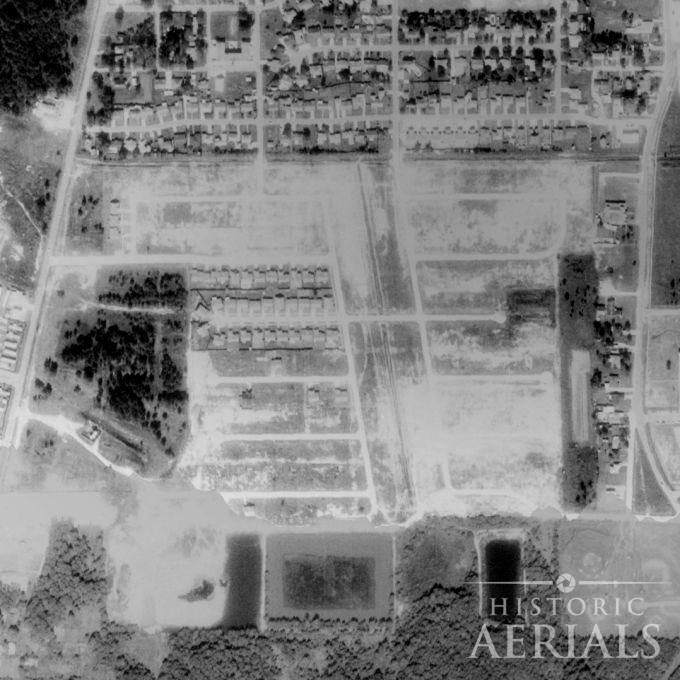
The correspondence with the earlier imagery is exact. Houses occupy the areas where pits did not exist. Vacant lots align precisely with where they did.
Development continued into the 1980s. By the mid-1990s, the existing homes were in place. Then construction stopped. Decades later, the same lots remain empty.
The subdivision was not left unfinished. It was built to a limit.
Building next to an active pit
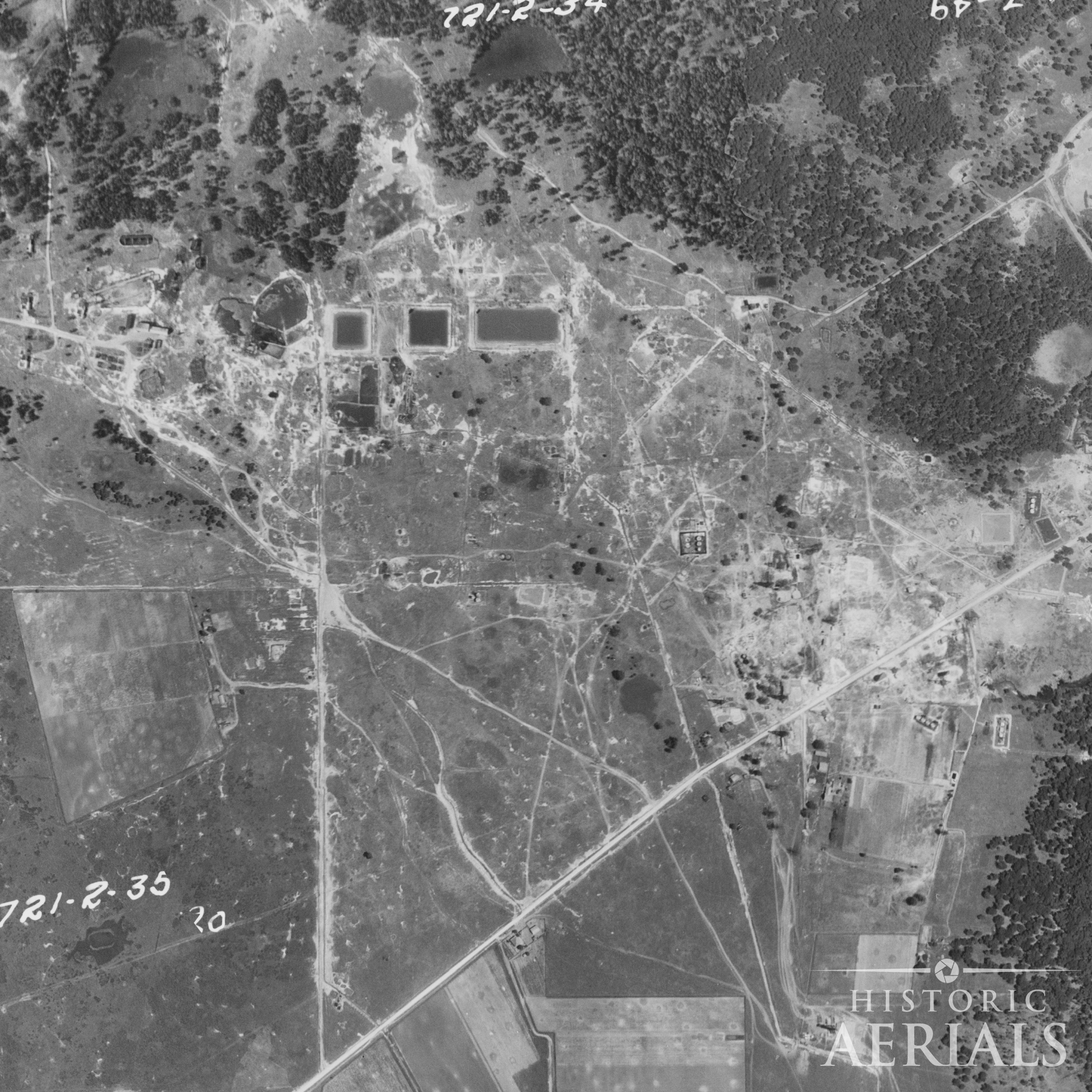
On the west side of Old Humble Road, a different approach appears in the imagery.
In 1966, a residential street is visible just south of the main pit complex. Immediately adjacent, within the same frame, is an open oil pit. Not a former site. Not a remediated one. An active pit, present at the edge of a newly built neighborhood.
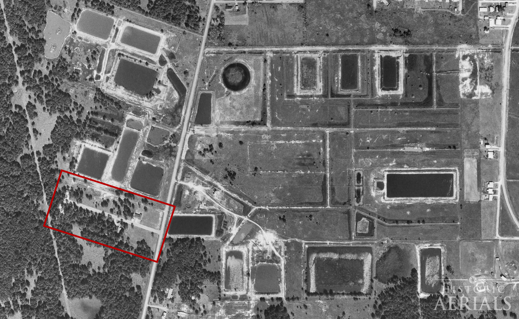
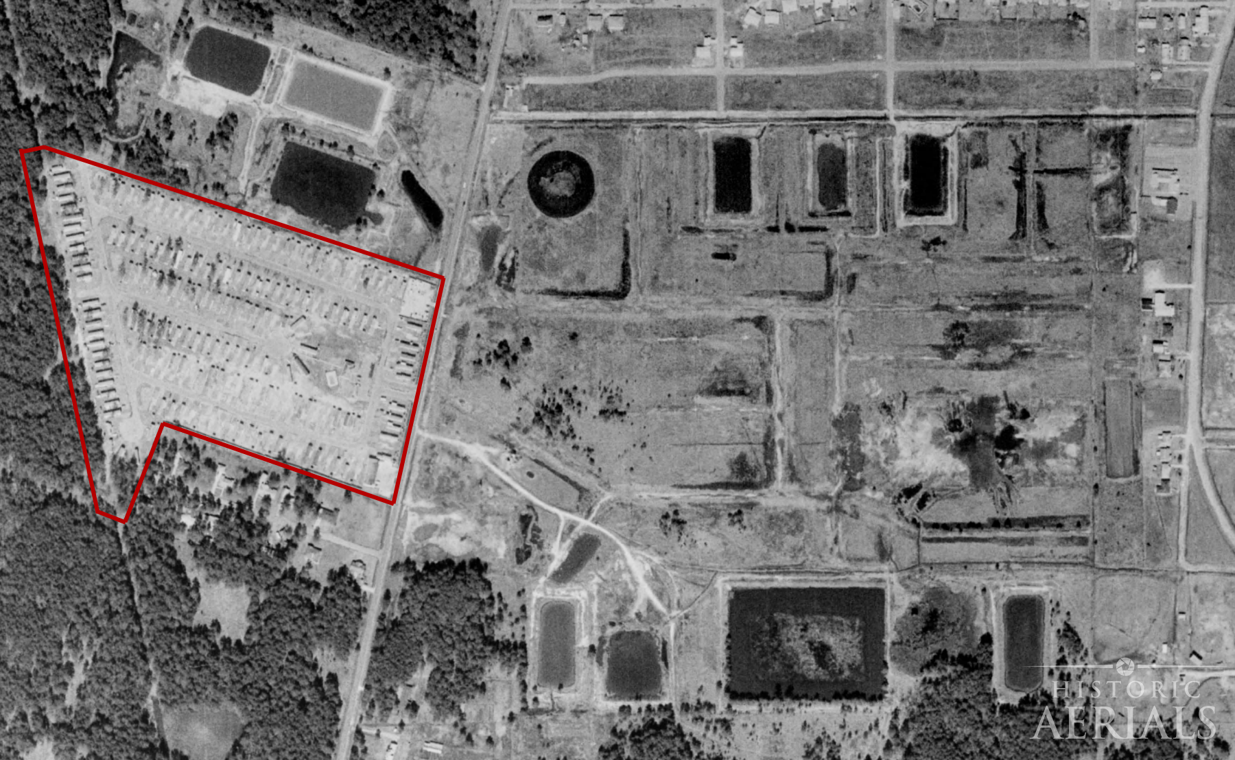
Between 1966 and 1973, a trailer park appears on the neighboring parcel. By 1982, USGS mapping shows “Trailer Park” and “Oil Wells” within the same map frame, separated by only a short distance.
People lived there.
By 1995, the trailer park is gone. The residential street remains. The structures are removed. The land is cleared and left open, matching the undeveloped portions across Old Humble Road.
The 1999 topo shows no trace of the prior use. No structures. No label. The record simply ends.
Across the road, one development stopped short of the pits. Here, construction proceeded alongside them and was later erased.
The same pattern across Humble
Memorial Glen is not an isolated case.
Across multiple sites in the Humble area, early aerial imagery shows oil pits or associated industrial activity occupying large, clearly defined tracts of land. In modern imagery, those same locations remain conspicuously free of residential development, even where surrounding areas have filled in with subdivisions.
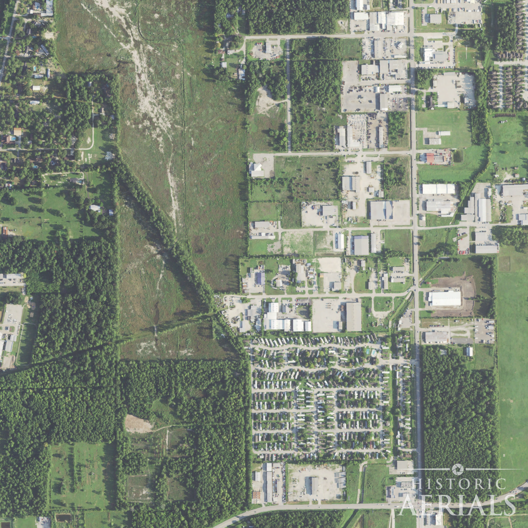
In several cases, the former pit sites have not remained unused. Instead, they have been repurposed for light industrial or commercial activity — yards, storage areas, or facilities that do not require the same level of residential suitability. The transition is consistent: where homes would imply long-term exposure for people living there, other uses take their place.
The correspondence is not general. It follows the exact footprint of the earlier pits. In the 1930 imagery, the impoundments appear as rectangular basins arranged in grids. In present-day imagery, those same shapes persist as open ground, altered terrain, or non-residential use, even as development presses in on all sides.
Across sites, the pattern repeats with enough consistency to recognize: where pits existed, houses generally do not. Where development does occur, it tends to shift toward uses that tolerate what residential construction does not.
The absence is not random. It is mapped to the past.
What’s still happening on the ground
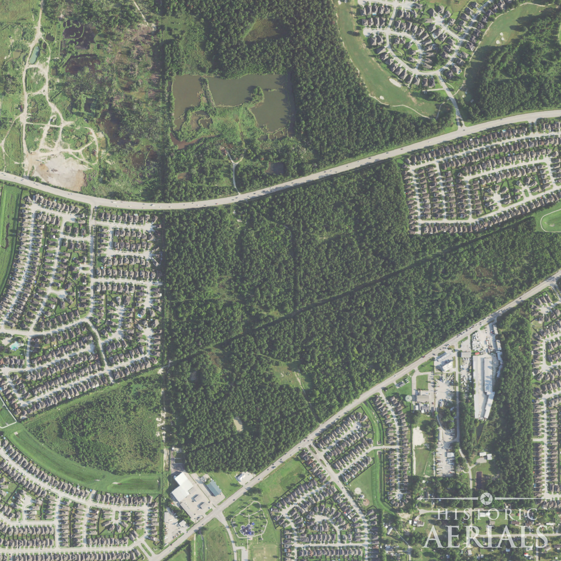
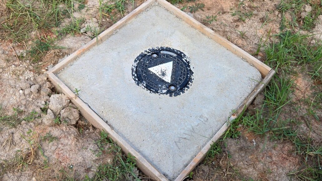
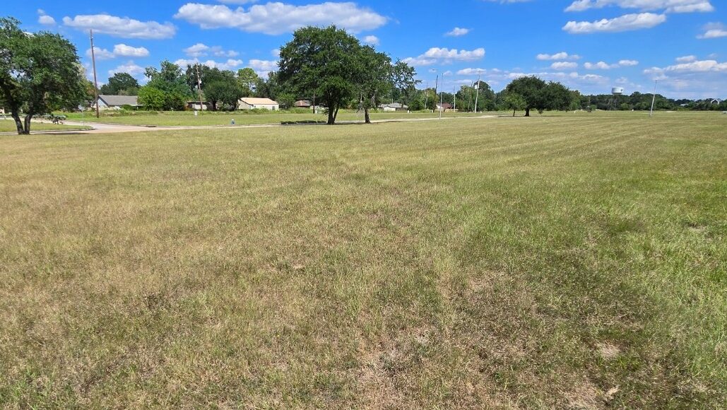
A visit to the Memorial Glen site confirms that the story did not end when development stopped.
Monitoring wells are visible across the vacant lots; small, easily overlooked installations set flush with the ground. They appear at regular intervals, indicating ongoing sampling.
In one area, a cluster of black drums sits in the grass, each labeled Non-Hazardous Waste. Material is still being collected and removed.
More than a century after the pits were first excavated, the site remains under active management.

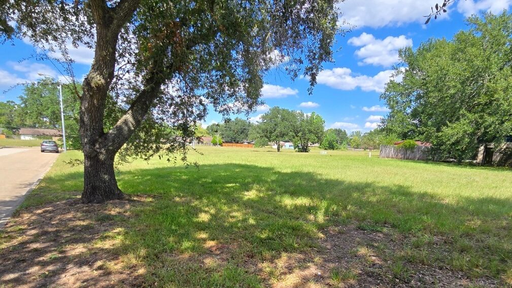
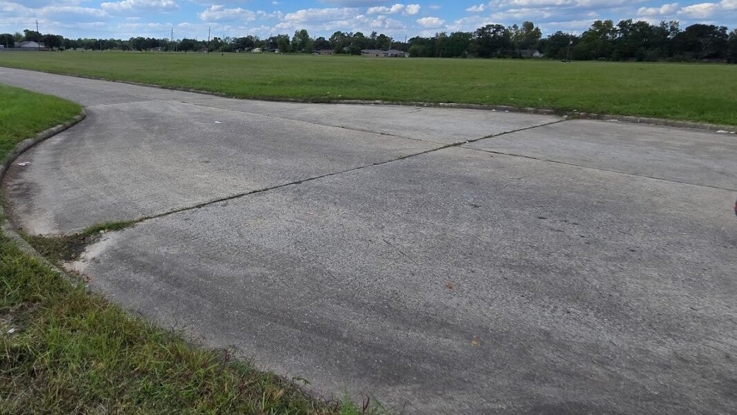
Standing along one of the undeveloped streets, the intent of the original subdivision is still visible. Streetlights remain. Trees planted along the lots have matured, forming a canopy that was meant to frame a finished neighborhood.
The infrastructure is there. The houses are not.
Reading the landscape over time
This pattern is easy to miss from the ground. I lived in Humble for years and never saw it for what it was. The incomplete streets registered as unfinished development, nothing more.
It only became legible when viewed from above, and then across time. The sequence is visible in the imagery.
The 1930 aerial shows the pits. The 1956 map records their abandonment. The 1966 imagery shows residential construction next to an active site. The 1981 imagery shows development adapting around the same constraints. The most recent imagery shows the long-term result.
Only by moving between images across decades does the relationship become clear. The layout of the present landscape reflects decisions made in response to conditions that are no longer visible, but not entirely gone.
Aerial imagery does not provide every answer. It preserves the sequence of events closely enough to show where development followed the land, and where it stopped.
Without that record, this would read as an unfinished neighborhood. With it, the outline of what happened is still visible.