I found a forgotten road with direct ties to the War of 1812. There are no historical markers there. Anyone I asked about it had no idea it even existed.
I’ve long indulged in learning everything I can about the history of the places where I live. Reading every history book of the area that I can find. Searching online for the oldest images and seeing if I can see what its subject looks like today. In 2013, my family moved to Wilmington, North Carolina.
It might as well have been a candy shop.
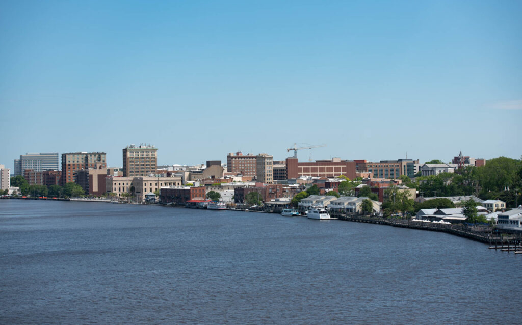
Wilmington sits on the banks of the Cape Fear River. It’s one of the oldest cities in the United States. more than a century older than major cities like Chicago and Atlanta — and it played important parts in the nation’s history, even before it was born.
As I always do when I’m researching, I looked for the oldest maps that I could reference and examine. Many of the useful ones for Wilmington were from around the Civil War era, which I had been reading about at the time.
A curious name on an old map
The maps showed me roads existing at the time and exactly where they were. I wanted to put myself in the footsteps of the people who tread those roads. But of course Wilmington has grown a lot since that time. Most of the roads marked were now covered by neighborhoods or shopping centers. I knew that the few traces that might remain would be gone soon too.
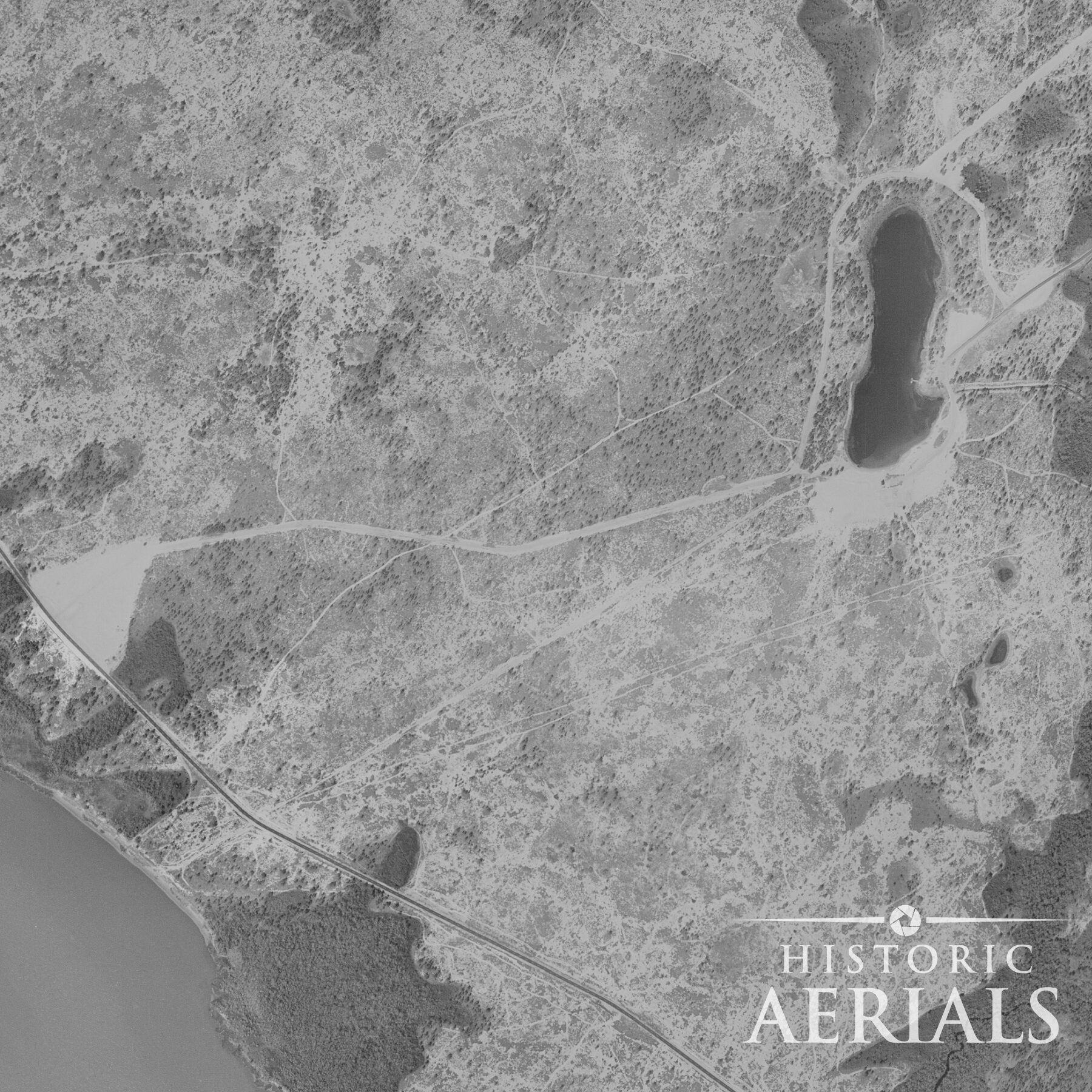
I noticed one road that had an interesting name: the “Old Salt Road”. On another map, the road led to a spot on the river labeled “Old Salt Landing of 1812.”
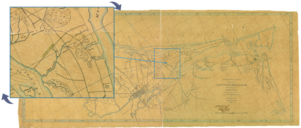
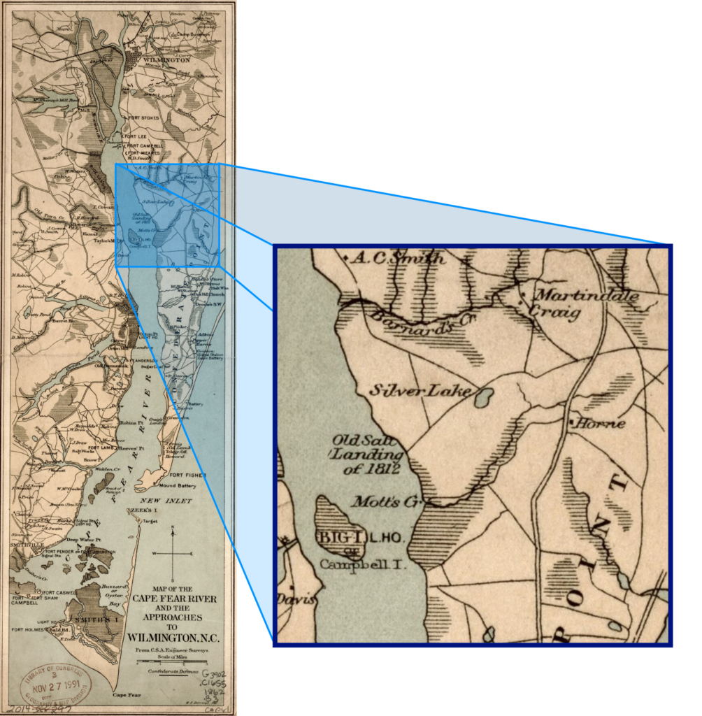
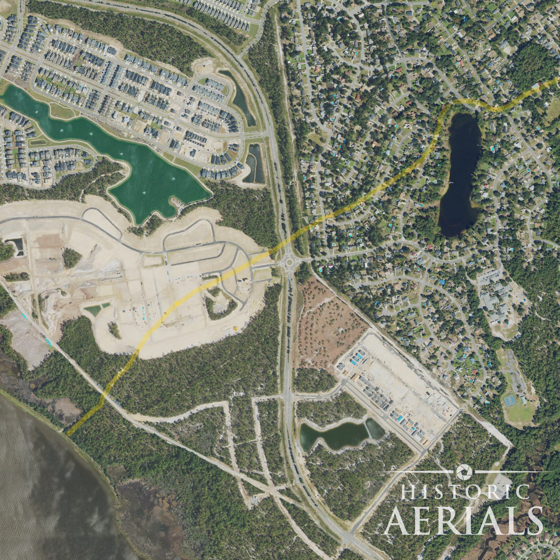
This area hadn’t been developed at the time, so maybe it was still there for me to find. Since these weren’t georeferenced maps, its location was ambiguous. But there was a landmark showing on the maps — Silver Lake — that the road ran directly to from the river. I immediately brought up satellite imagery on Google Maps, thumbing my way to the spot.
There it was.
Silver Lake, a name still used today, was right where it should be. And the road leading from it to the river, I could see a trace of it. A subtle, but undeniable, line in the landscape.
What the road remembers
Before I went out to the site, I wanted to find out what I could about this Salt Landing. Here’s what I learned:
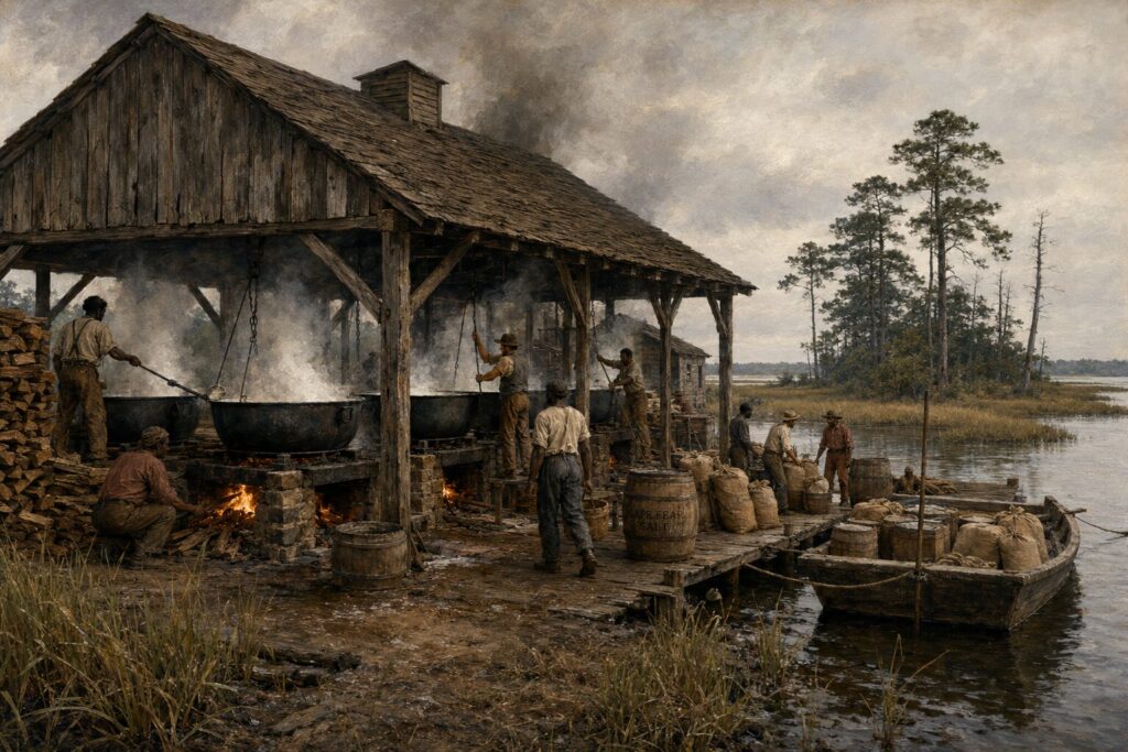
What I found out surprised me. The road wasn’t just old; it was a direct product of the War of 1812. When naval blockades cut off cheap salt imports, locals set up salt works along the sounds of New Hanover County. The road existed to move that salt overland to the Cape Fear, where it could travel upriver to supply inland counties. A war being fought hundreds of miles away had drawn a line in the landscape right here.
A sandy path to nowhere in particular
I was determined to find this road. Since I had seen it on Google Maps, it wasn’t hard to find. I got out and walked along the sandy path toward the Cape Fear River. To be honest, there wasn’t much to see, but plenty to imagine. As I walked, I tried to conjure the sound of wagons heavily loaded with hundreds of pounds of salt, making their way to the landing from which the salt could be transported upriver to supply the inland counties.
Here were real traces of the past right at my feet. History was right here; important history, effected by things happening in different parts of the world.
My visit to the site didn’t yield any archaeology, or provide any more facts than what I had already learned. But what I gained is harder to define. It was presence; direct contact with the past.
The experience stuck with me. Here were real traces of the past right at my feet. History was right here. Important history, affected by things happening in different parts of the world.
Still there, if you know how to look
Old roads like this one are a significant, but often overlooked, element of our collective past. For archaeologists and historians, sites like this one remain largely unexplored. The kind of place where the ground likely still holds its secrets.
In America, Native Americans often forged roads traversed by animals during seasonal migrations hundreds of years ago. Later generations adopted, modified, and utilized these roads. We learn about all kinds of people, events, and places in history. These paths are what connected all of it. The human experience is driven by movement.
Historic aerial imagery turned out to be the answer to a problem I didn’t know had a solution yet. When I discovered it years later, I looked this site up immediately. The same line that continues to fade away in modern views stands out prominently in those older frames. Clear, purposeful, undeniable. It’s as if the Old Salt Road was begging to not be forgotten.
We study the great events and the famous names. But history also lives in a sandy path through the Carolina lowlands, in a forgotten road with a name that tells you exactly what it was for. These small details are still out there, waiting to be noticed. We won’t forget what we can still see.