As discussed in a previous article, From War to Discovery (11/7/2024), World War I gave rise to the new science of interpreting information contained in aerial photographs. Specialists in this emerging field learned to identify features and discern their meanings, developing techniques to maximize visibility by considering lighting, seasonal, and even climatic conditions. After the war, archaeologists reviewing the photos used these same techniques to look for traces of the past.
What did they see in these photos?
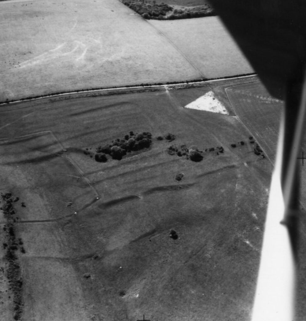
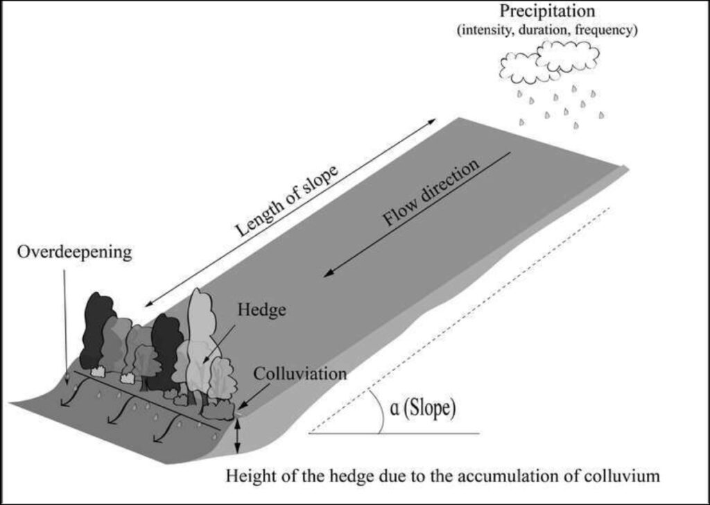
One feature often visible in aerial photographs is shadow marks. For example, ancient agricultural field systems are revealed by shadow marks cast by lynchets. Lynchets are vertical ridges that develop on the downslope of a field after centuries of plowing. These features are most visible early in the morning or evening, when the low angle of the sun casts shadows that highlight even the subtlest variations in the terrain.
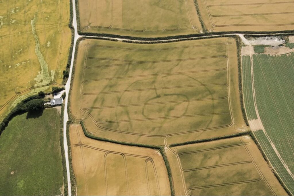
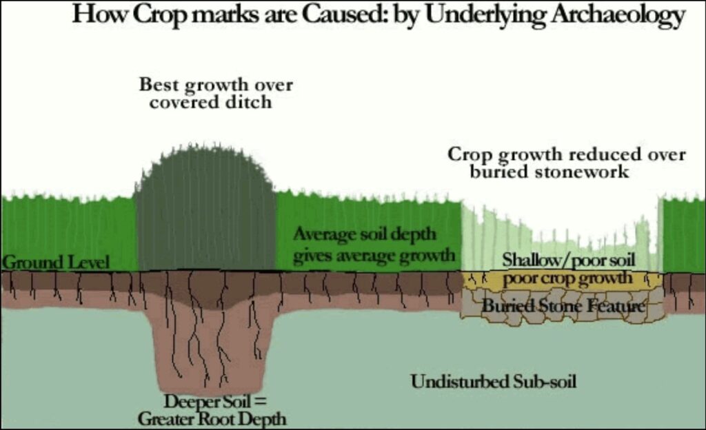
Another significant feature revealed through aerial photography is crop marks or soil marks, which are caused by variations in vegetation growth due to what lies beneath the surface. Crops growing over areas with richer soil, such as filled ditches or trenches, appear greener and taller, while those growing over poorer soil, like stone walls or foundations, are shorter and less vibrant. This contrast creates striking patterns that are visible from above, offering valuable clues to hidden archaeological sites.
In the early decades of aerial archaeology, thousands of sites were uncovered using these methods. In fact, aerial imagery has been responsible for the discovery of more archaeological sites than any other survey method. This wealth of knowledge has significantly deepened our understanding of human history, culture, and behavior.
And the discoveries haven’t stopped. Advances in technology, lidar and other forms of remote sensing, now allow us to peer beyond the visible spectrum, uncovering secrets buried beneath dense forests or hidden under layers of earth. In our next article, we’ll explore how these groundbreaking innovations continue to push the boundaries of what we can see from the skies.