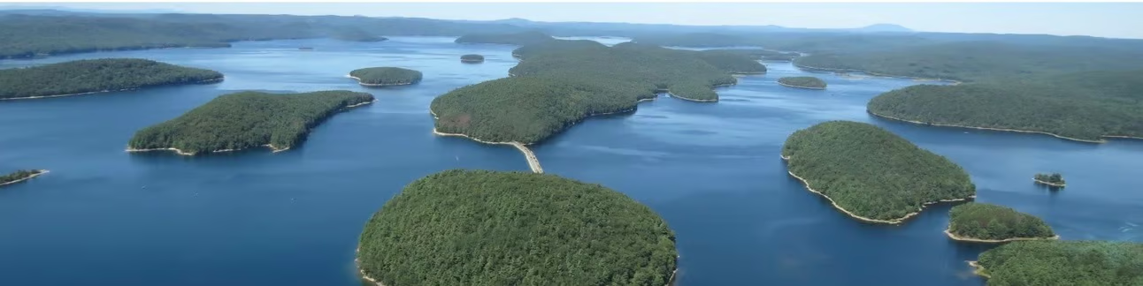
Beneath some of America’s most popular lakes, there are roads. Foundations. Railroad beds. The grid of streets that once organized someone’s entire life. The water is calm and the scenery is beautiful, and almost nobody standing at the shore knows any of this.
That’s the thing about progress. It buries what came before.
Towns built to disappear
The 20th century was the great age of American dam-building. Hydroelectric power, flood control, municipal water supply. The logic was sound, the engineering was impressive, and the reservoirs that resulted became fixtures of regional life. What the history books tend to underemphasize is what went under. Farms. Churches. Cemeteries. Whole towns that had existed for generations, disincorporated by legislative decree and then slowly swallowed by rising water.
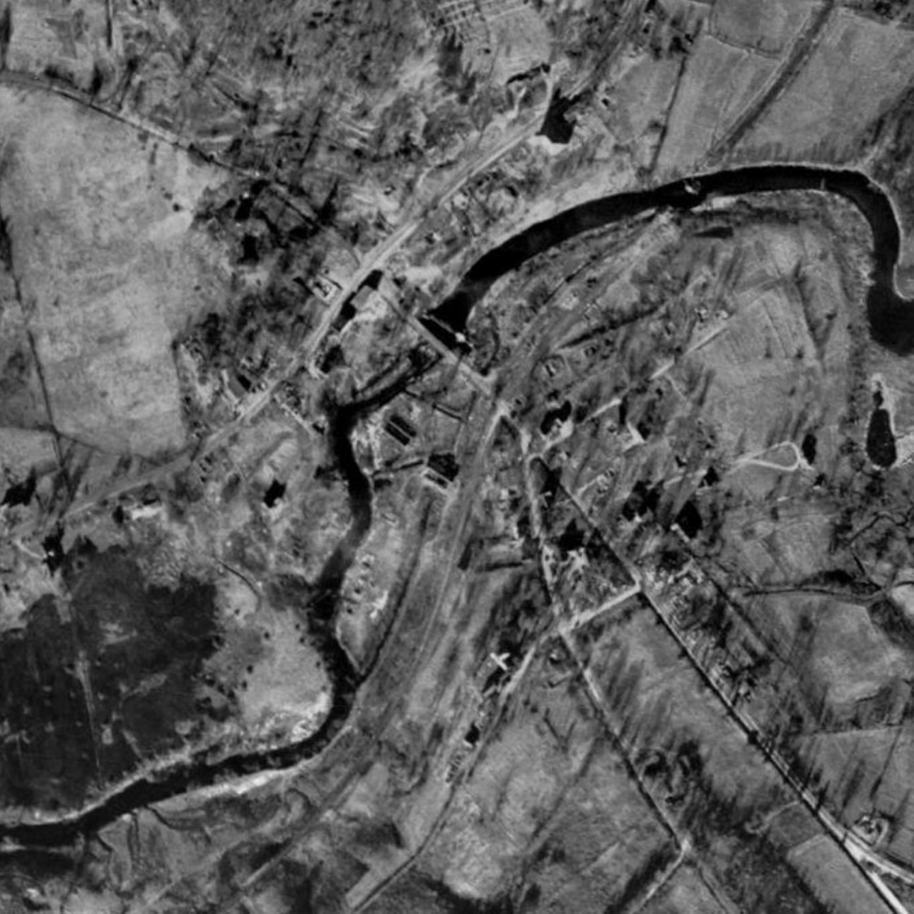
Enfield, Massachusetts had been part of the Swift River Valley since the 1700s. In the 1930s, Boston needed water. The solution was the Quabbin Reservoir, one of the largest man-made public water supplies in the country, and Enfield was in the way. On April 28, 1938, the town was officially disincorporated. Buildings were razed or relocated. The water rose. Today the Quabbin is a vital regional resource and a quiet, scenic place. Beneath it, Enfield is still there — in the arrangement of the land, in historic records, and in aerial images taken just before the valley filled.

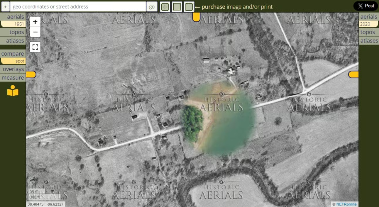
Indiana’s quiet erasure
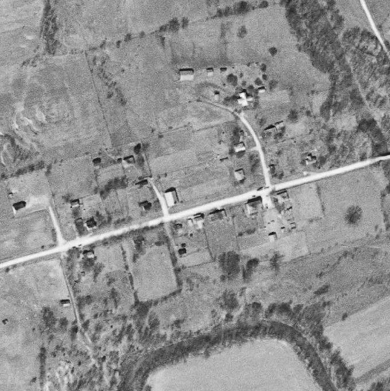
Newton Stewart, Indiana told a similar story a few decades later. A small community in the rolling hills of southern Indiana, it was cleared in the 1960s to make way for the Patoka Lake Reservoir, built by the U.S. Army Corps of Engineers for flood control and water supply. The town was relocated and demolished. The reservoir filled. Visitors come now for the scenery and the fishing, largely unaware that a functioning community once occupied the same ground.
These weren’t isolated cases. Lake Lanier in Georgia, Lake Shasta in California. Across the country, towns, railroad lines, and farmland disappeared under reservoirs that generations of Americans have since come to think of as natural features of the landscape. The erasure was so complete, and so long ago, that the loss itself got lost.
This is where aerial imagery does something remarkable. Historic Aerials holds images of these places taken before the water came, where the streets still dry, the buildings still standing, the community still legible from above. Comparing those images to current aerials using the spotlight tool makes the submersion tangible in a way that written history rarely achieves. You can trace exactly where Newton Stewart sat. You can see the outline of Enfield against the landscape that would become the Quabbin’s floor.
The towns are gone. The images aren’t. That’s worth something.
For those who are curious about the hidden histories of their local landscapes, exploring these aerial images is like stepping back in time. It’s an opportunity to reimagine the lives of those who lived in these places, to understand the sacrifices made in the name of progress, and to connect with the forgotten stories beneath the lakes we see today.