What does it take to photograph an entire country? That question consumed military planners, government surveyors, and commercial mapping companies throughout the twentieth century. The answer turned out to hinge on something almost mundane: a strip of flexible film on a spool, advancing through a camera one frame at a time. The implications were anything but mundane.
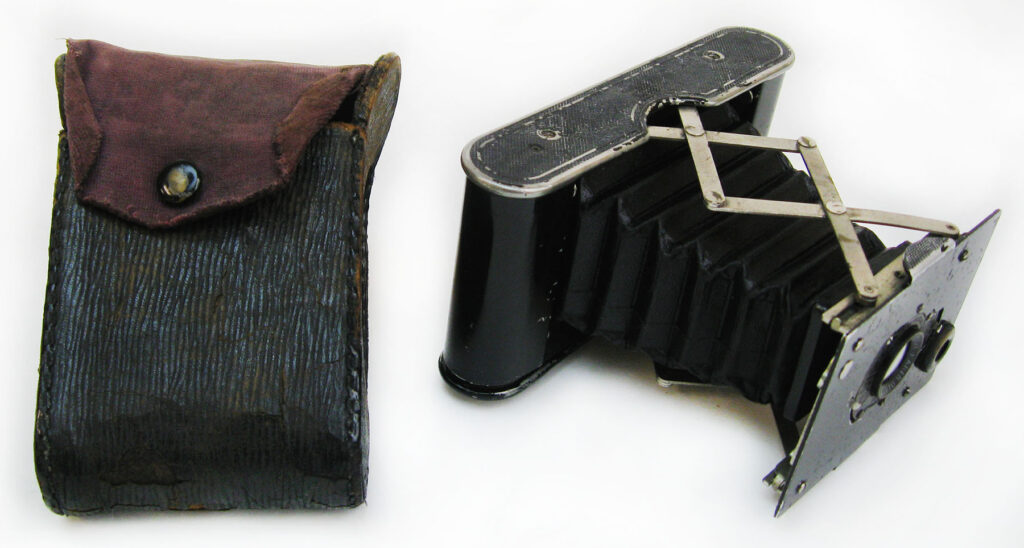
For the first half‑century of photography, every image meant handling a rigid plate of glass. Photographers carried boxes of them. Each exposure required removing one plate and replacing it with another. In the air, that limitation mattered. Early aerial photography, whether from balloons, kites, or the first airplanes, was constrained by the same problem. A glass plate camera could produce remarkable images, but it was heavy, fragile, and slow to operate. Every photograph was a separate operation.
Roll film changed that equation.
Instead of loading individual plates, photographers could load a continuous strip of light‑sensitive film wound onto spools. The camera advanced the film after each exposure, allowing multiple photographs to be taken in rapid sequence. That single mechanical change opened the door to a new way of photographing the Earth from above.
What roll film actually was
Roll film is exactly what the name suggests: a long strip of flexible photographic film wound onto a spool. During use the film moves from a supply spool to a take‑up spool inside the camera.
That sounds simple, but the system required an entirely different kind of camera architecture.
Unlike plate cameras, roll‑film cameras needed supply and take‑up spools to hold and advance the film, winding keys or crank mechanisms to move it between exposures, tensioners and rollers to keep it traveling smoothly through the camera body, and pressure plates to hold the film perfectly flat at the moment of exposure.
Keeping the film flat was critical. Even a slight curve in the film could distort an aerial photograph or throw the image out of focus across the frame.
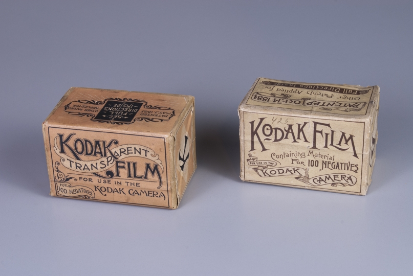
Early roll film also came in a wide variety of sizes. Unlike the standardized 35mm film many people remember from the late twentieth century, aerial cameras often used custom film widths tailored to the camera’s design and the size of the negatives required for mapping.
In other words, the camera wasn’t designed first and then loaded with film. The camera was engineered around the film itself.
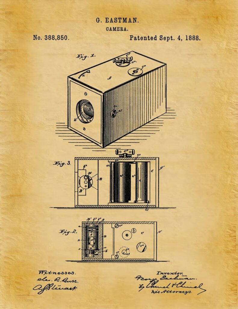
Kodak and the industrialization of film
Much of that film, especially in the United States, came from one company. Eastman Kodak didn’t just manufacture roll film; it helped define how it would be used. By the early twentieth century, Kodak had refined flexible film bases and standardized enough formats to make large-scale photographic work practical, even if aerial cameras still relied on custom widths. Just as important, Kodak’s consistency meant that survey companies and military units could rely on predictable results across thousands of exposures.
When aerial photography began to scale in the 1920s and 1930s, it did so on a foundation of industrially produced film that behaved the same way from one roll to the next — a requirement that becomes obvious when an entire mapping project depends on hundreds of perfectly exposed, evenly developed images.
Why roll film was perfect for the air
The advantages of roll film became obvious as soon as cameras began flying regularly in airplanes.
Continuous photography
Roll film allowed a camera to take many photographs in sequence without needing to reload. This was perfect for aerial mapping.
By the 1920s and 1930s, aerial survey aircraft commonly flew straight lines over the landscape while cameras captured images at regular intervals. Each photograph overlapped the previous one slightly, creating the raw material for stereoscopic mapping.
That process would have been painfully slow with glass plates. With roll film, the camera simply advanced the film between exposures and kept shooting.
Larger negatives for mapping
Aerial photography required large negatives to capture detail across wide landscapes.
Many early aerial cameras used film several inches wide (sometimes 5 inches, 7 inches, or even larger) producing negatives capable of resolving fine ground detail from thousands of feet in the air.
These large film formats became the backbone of photogrammetry, the science of measuring terrain from photographs.
Faster exposure, faster shutters
As photographic emulsions became more sensitive to light in the early twentieth century, exposure times shortened dramatically.
That improvement was crucial for aerial photography. Aircraft vibrate. They move quickly. Long exposures blur the image.
More sensitive film allowed cameras to capture images in fractions of a second. But that improvement forced another change: mechanical shutters had to become faster and more reliable.
Engineers developed precision focal‑plane shutters and rotary shutters capable of firing rapidly so cameras could expose frames at regular intervals as the aircraft moved along a survey line.
The evolution of film sensitivity and shutter speed happened together, each pushing the other forward.
Cameras built around the film
Because roll film formats varied widely, aerial camera designs varied just as much.
Several general camera types emerged during the early decades of aerial photography.
Hand‑operated roll‑film cameras
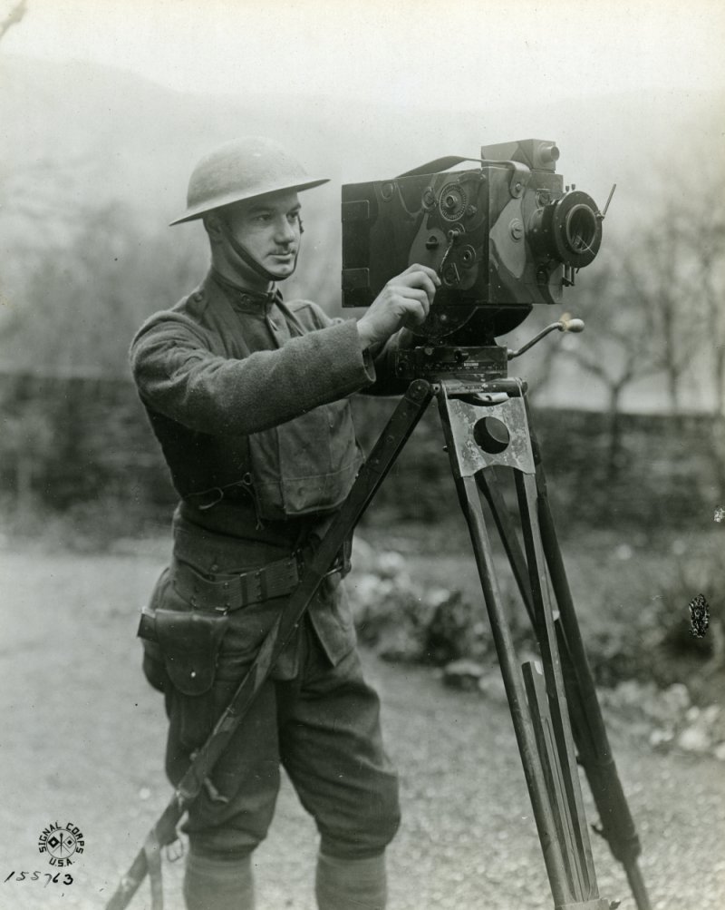
Early aviators often carried cameras adapted from ground photography. The photographer manually advanced the film using a winding key.
During World War I, observers used cameras like these from open cockpits to photograph enemy trenches and artillery positions below.
These cameras were simple but limited. The photographer still had to manage the camera manually while flying in unstable aircraft.
Interval‑driven aerial survey cameras
By the 1920s, specialized aerial cameras began using mechanical timers that triggered exposures automatically at fixed intervals.
The film advanced after each exposure while the aircraft maintained a steady flight line.
This design proved ideal for government mapping projects and early commercial aerial surveys, where long strips of overlapping photographs were needed to map terrain accurately.
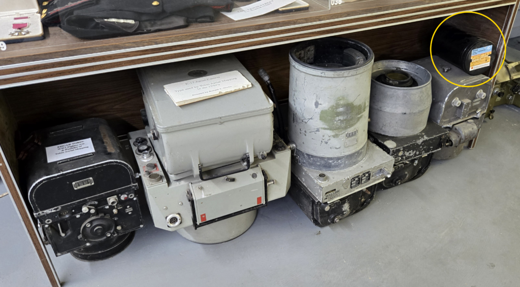
Large‑format mapping cameras
As aerial mapping matured, cameras grew larger and more precise. These cameras used wide rolls of film and carefully engineered pressure plates to keep the film perfectly flat.
Cameras of this type soon became standard for national mapping programs, military reconnaissance, and large-scale land surveys.
These cameras produced the high‑resolution negatives that made stereoscopic mapping practical.
Aerial photography becomes industrial
Roll film industrialized aerial photography. A single flight could produce hundreds of photographs covering vast areas of land. Survey companies began systematically photographing entire regions, producing detailed maps and photographic archives of the landscape.
One of the best‑known companies in this field was Tobin Aerial Surveys, founded by aerial photographer Edgar Gardner Tobin.
Throughout the mid‑twentieth century, Tobin’s aircraft photographed oil fields, cities, transportation corridors, and rural land across the United States. The cameras aboard those aircraft relied on roll film systems capable of capturing long sequences of overlapping images.
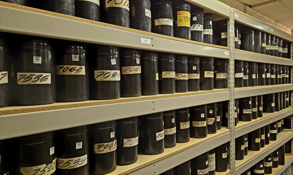
Each flight produced rolls of film that documented the landscape at a particular moment in time.
When digital replaced film
Roll film remained the dominant medium for aerial photography for most of the twentieth century.
By the late 1990s and early 2000s, however, digital sensors began replacing film cameras in aerial survey aircraft.
Digital systems offered several advantages, including immediate image review, faster processing workflows, the elimination of physical film handling and storage, and direct integration with digital mapping software.
Despite these benefits, decades of aerial film remain one of the richest historical records of the landscape ever created.
Preserving the film era
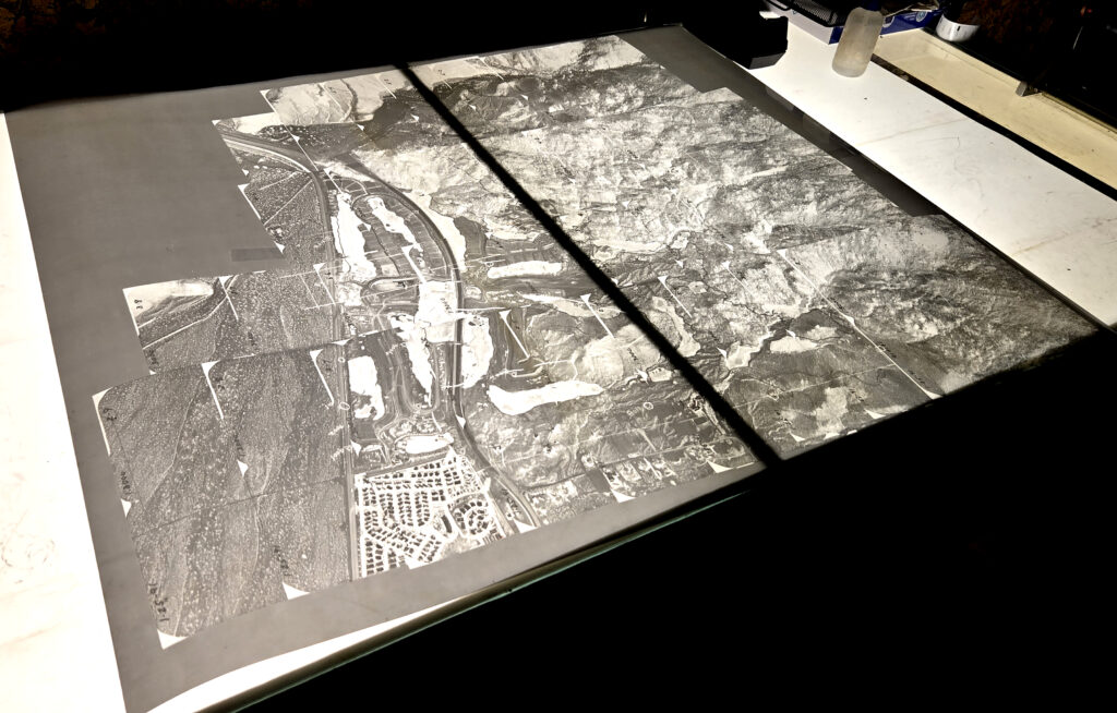
Those film archives are still being rediscovered and digitized today.
At Historic Aerials, large collections of aerial film have been scanned and converted into high‑resolution, orthorectified digital imagery. Among the most important is the Tobin Aerial Surveys collection, which preserves thousands of aerial photographs captured on roll film during the mid‑twentieth century.
Once digitized, these images become far more than historical curiosities. They allow researchers, historians, environmental scientists, and property owners to see how landscapes have changed over time.
The film may have been exposed decades ago — but the information it contains is still working.
The legacy of a mechanical medium
Roll film solved a practical problem: how to take many photographs quickly from a moving aircraft.
But the consequences were much larger.
It allowed aerial photography to move beyond experiments and become a systematic way of recording the Earth’s surface. Entire regions could be photographed, measured, and archived.
Today those photographs remain one of the most detailed visual records of the twentieth‑century landscape. And most of them began as a strip of film moving through a camera thousands of feet above the ground.