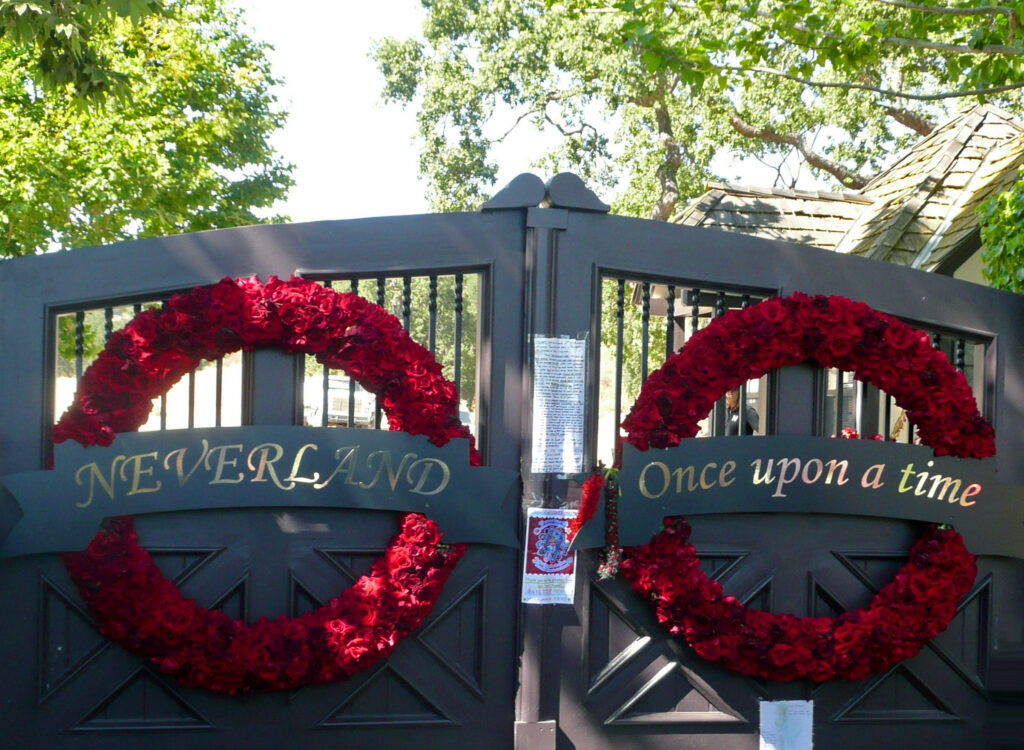
Everyone is looking inside the mansion again. The recent releases of the blockbuster biopic, Michael, and the Netflix docuseries, Michael Jackson: The Verdict, has us peering at the rooms, the rides, the relics of Michael Jackson’s Neverland Ranch. It’s the same images that have been picked over for thirty years. We wanted to look at it in other direction. Down.
From directly overhead, the estate at 5225 Figueroa Mountain Road tells a different story than any tour of its interior ever could. The aerial record is the only witness that saw all of it: a cattle ranch, a developer’s European manor, a pop star’s private amusement park, and a billionaire’s empty preserve — four separate fantasies imposed on the same 2,700 acres, each one eventually shrugged off by the ground beneath it. The structures changed. The valley stayed.
Here is that century, in five frames.
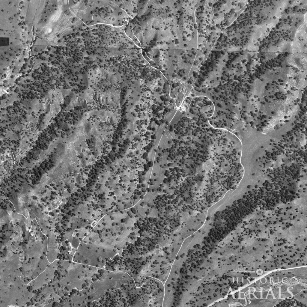
1967 — Before
Working ranch land in the Santa Ynez foothills. The valley floor is cleared and grazed, threaded by a network of dirt roads, with a single cluster of structures at the center. No manor, no compound, no lake. Just terrain doing what terrain in this county had done since the Mexican land-grant era — carrying cattle. Everything that came later was built on this.
1981 — The first dream
Developer William Bone, who had bought the bare acreage from the estate of a Crocker National Bank founder, breaks ground on a French Normandy manor. In this frame the building pad is freshly cleared and the first structure is rising on ground that, a few years earlier, held nothing. Bone called it Sycamore Valley Ranch and meant it to be the ultimate private estate — fifteen years of homebuilding poured into one site. He was, without knowing it, laying the skeleton the next owner would inherit.
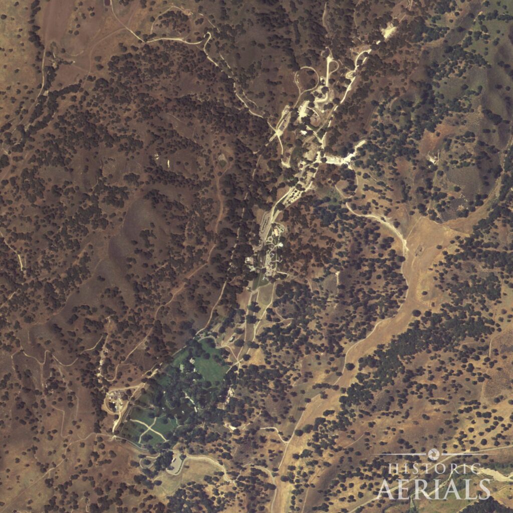
1994 — The peak
Jackson bought the property in 1988, renamed it Neverland, and over the following years built his amusement park on what county records describe as “bare dirt,” with permits beginning in June 1990. By the mid-1990s the estate is at its fullest: a developed compound, a rail line running through it, and the excavated lake holding water at the center of it all.
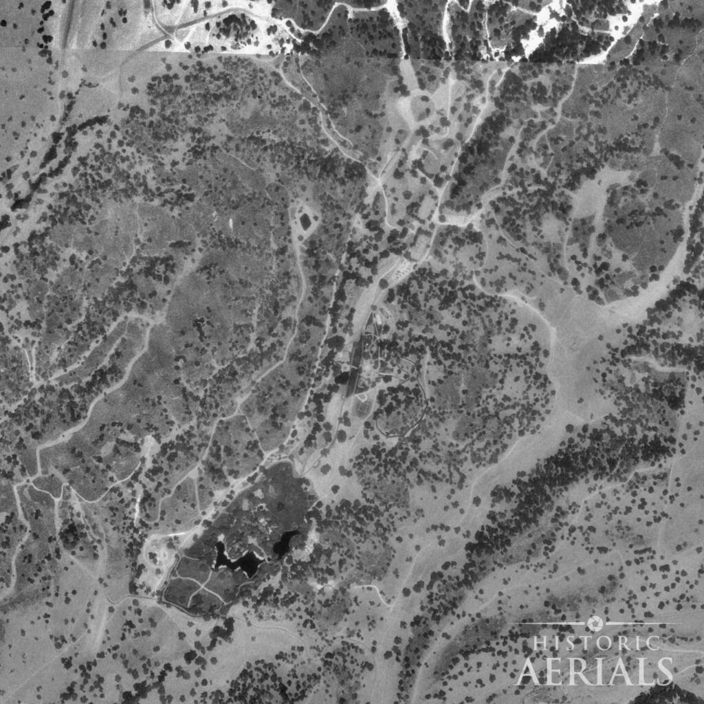
A word about this frame: it’s dark. The 1994 aerial came down to us as a flat, low-contrast exposure, and we’re showing it exactly as captured. You have to look harder here than in the other frames, but the essentials are there if you let your eye settle: the developed footprint around the lake, the line of the railway running through, the dark water at the center. We’d rather you squint at the real record than hand you a polished picture that isn’t quite what the camera caught.
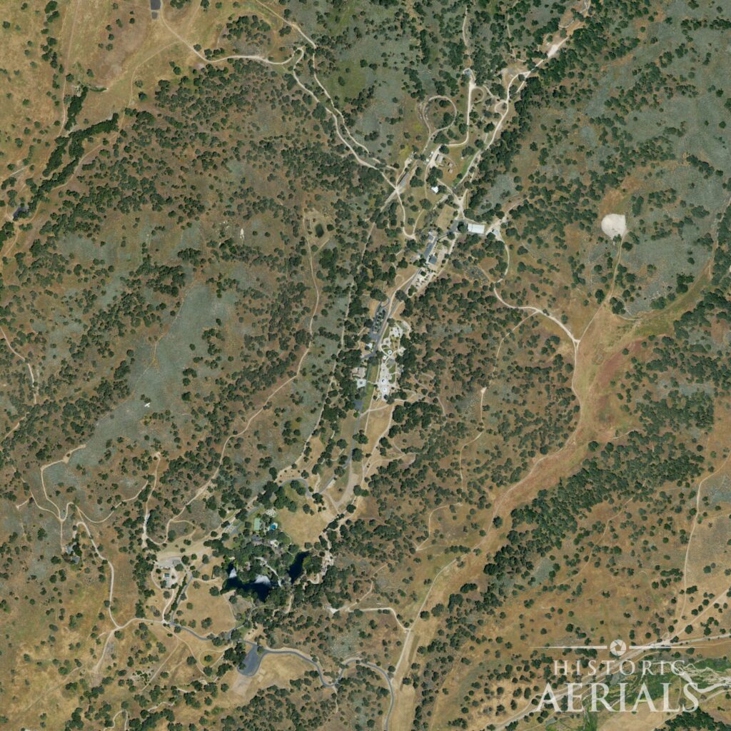
2005 — Abandoned
The year Jackson left for good. Following his acquittal, he vacated Neverland and never returned. In this frame everything is still there — the full compound, the rail line, the lake, the developed grounds — intact and maintained, but with no one living the dream that built it. The park is complete and already a relic. From above, an abandoned fantasy and a thriving one look nearly identical. That’s the quiet horror of the 2005 frame.
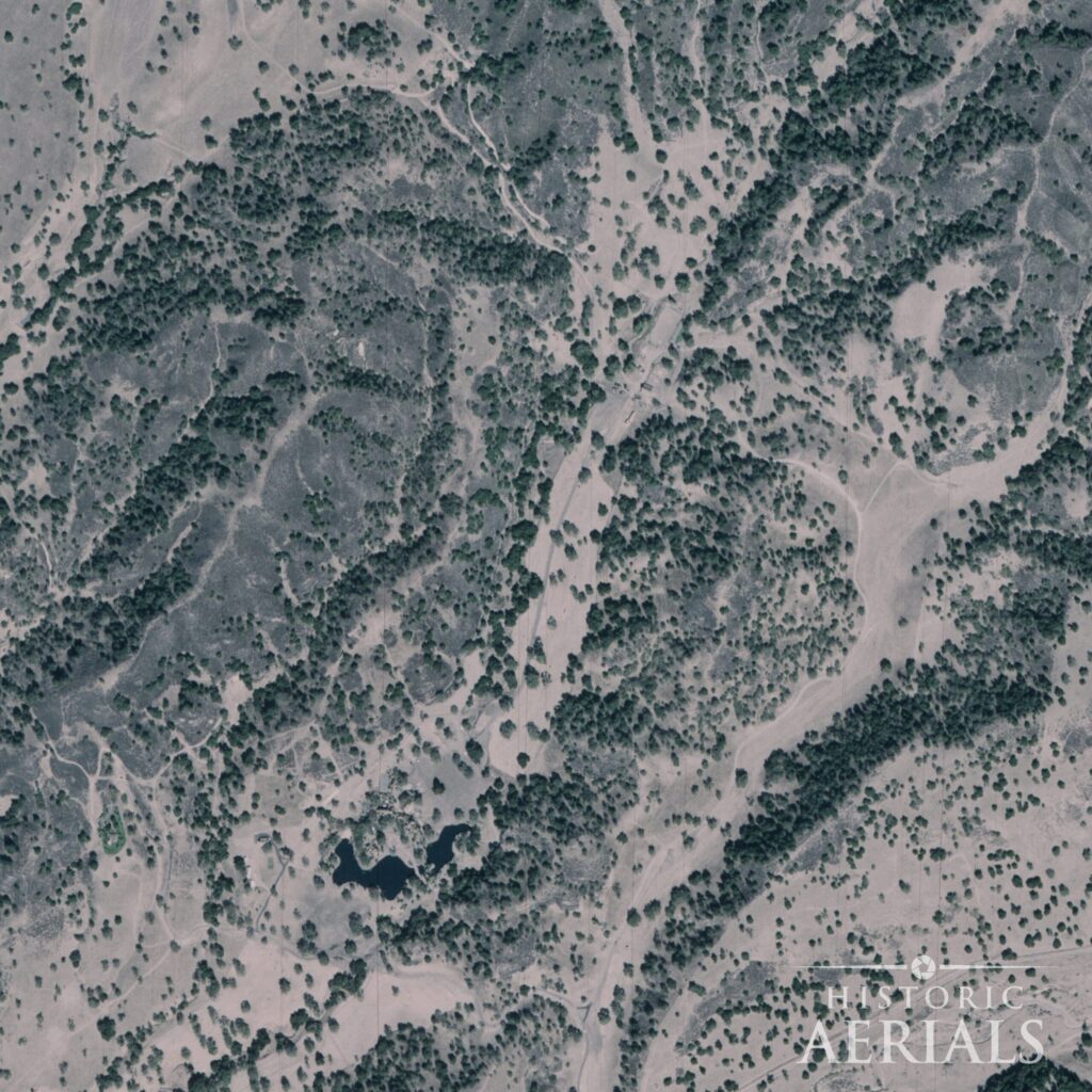
2024 — Erasure
After Jackson’s death in 2009, the rides were dismantled and trucked off; some of them — the Zipper, the Spider, the Lolli Swing — were bought by carnival operators and still run, in pieces, at the California State Fair in Sacramento and across the western fair circuit. The carnival is gone from the land. But the compound remains, and the lake remains, and where the developed zones once stood you can see cleared ground returning to quiet. Billionaire Ron Burkle bought the estate in 2020 for $22 million, a property listed at $100 million just five years earlier. The land was always worth something close to its sale price. It was the name that had been worth $100 million, and the name had gone toxic.
Four owners, four dreams, one parcel. The cattle ranch, the manor, the amusement park, the preserve. Each imposed itself on this valley with total confidence, and each was eventually undone. Only the lake and the basic footprint of the land carried through all of it.
There’s a final irony in publishing these. The current owner has gone to court over unauthorized aerial photography of the property, fiercely guarding its airspace. What you’re looking at here is something different in kind: dated historical and government aerials, the public record stretching back decades — 1967, 1981, 1994, 2005, 2024. That’s not a drone over a private estate. That’s exactly what HistoricAerials is, and it’s the one vantage no owner has ever managed to wall off. The land kept no secrets from above. It never has.