
Aerial Perspectives on the Francis Scott Key Bridge History
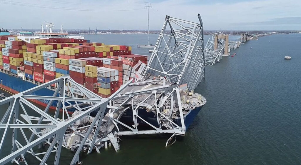
Steel folded like paper, concrete sheared into jagged edges — the collapse of the Francis Scott Key Bridge left a visual imprint that’s hard to forget. News coverage delivered every angle from ground level and above, but even in those first hours, one thing felt missing: a view stretching back before the bridge existed at all. That’s where the Francis Scott Key Bridge history aerials reveal something the breaking-news cameras never could — the long arc of how this crossing came to be.
Historic Aerials holds imagery of Baltimore’s outer harbor reaching as far back as 1957. In those frames, you see not just the footprint of a future bridge, but a piece of regional planning that took two decades, a few political fights, and one major pivot to finally take shape.
The Outer Harbor Before the Bridge
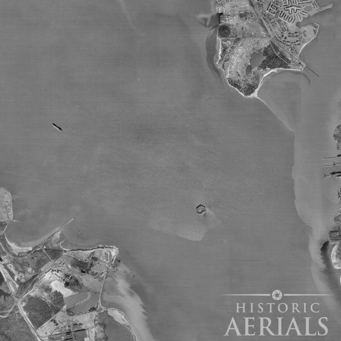
The 1966 aerial makes something immediately clear: there was no outer harbor crossing — not even the hint of one. What you see is a wide, uninterrupted sweep of the Patapsco River between Hawkins Point and Sollers Point. By then, local and state officials were already deep into conversations about an east-west connection that could relieve congestion on the older Harbor Tunnel and complete the beltway loop encircling Baltimore.
This was the era when the Baltimore region’s transportation planning shifted from one-off fixes to long-term, big-picture infrastructure. The outer harbor crossing was meant to be the project that tied everything together, forming the final missing link along I-695.
Why the First Plan Was a Tunnel, Not a Bridge
In the early planning stages, a bridge wasn’t even on the table. Maritime interests — especially shippers who relied on access to the port’s deeper terminals — feared a bridge would someday limit vessel size or create navigational bottlenecks. Political pressure followed, and the initial legislation authorizing bond financing required that the new crossing be a two-lane tunnel.
That decision looked routine at first. Then the bids arrived.
The construction estimates for a tunnel came back far higher than expected, blowing past budget projections and threatening to stall the entire project. The State Roads Commission was forced into a difficult but necessary question: was a tunnel still the best way forward?
Cost, not design philosophy, opened the door to a radically different solution.
The Aerial Clue: Causeways Built for the Wrong Project
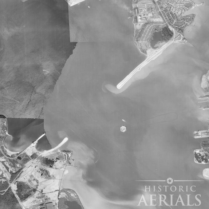
Even as the tunnel debate dragged on, construction crews pushed ahead with work on two long embankments extending from each shoreline. These weren’t speculative experiments — they were built specifically for a submerged tunnel alignment. But engineers left themselves an escape hatch: the causeways were designed so that if the plans changed, they could be repurposed for a bridge.
In the 1971 aerials, those causeways appear as geometric fingers reaching into the Patapsco. It looks like a bridge project already underway, even though on paper the crossing was still technically a tunnel. That single image says more about Maryland’s political and engineering balancing act than most reports ever captured.
Reevaluating the Project: From Tunnel to Bridge
Once the tunnel bids shattered the financial model, state officials began a top-to-bottom reanalysis. Could a bridge be built instead — and could it be done within the same general footprint?
The answer landed in favor of the bridge. The design was revised into a four-lane steel cantilever bridge, significantly boosting traffic capacity over the originally planned two-lane tunnel. The causeways, already in place, became the backbone of the approach spans. What had been the start of a tunnel suddenly became the first chapter of a bridge.
Building the Francis Scott Key Bridge
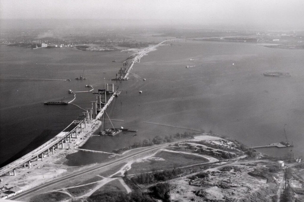
Construction broke ground in August 1972. Historic photos from the era show steel crawling upward from those earlier embankments, the framing extending over water that had never hosted anything more than barges and small working vessels. The transformation didn’t just reshape the shoreline — it reoriented how the greater Baltimore region connected with itself.
It took nearly five years to complete the structure. When the bridge opened in March 1977, it carried more than commuters. It carried a new identity for the outer harbor, one where industrial landscapes, port facilities, and neighborhoods on opposite sides of the Patapsco suddenly felt stitched together more tightly than ever.
The Bridge in Its Prime
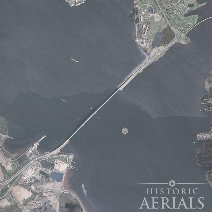
The 1981 aerial shows the bridge at its earliest full stride — slender, balanced, a long sweeping arc cutting across the water with the confidence of a structure meant to last generations. Industrial terminals curved around its approaches, trucks traced steady paths over its deck, and the ring of I-695 finally closed into a continuous loop.
For nearly half a century, the Key Bridge served as a vital artery for the region’s economy and daily life. Its role extended beyond convenience; it shaped trade routes, commutes, neighborhood developments, and the cultural geography of the city.
Through all that time, the aerials tell an evolving story: shipyards shifting, terminals expanding, new road networks branching outward. The bridge remained the anchor tying it all together.
A Landmark Lost, a History Preserved
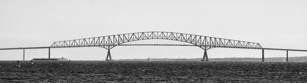
The collapse may have brought the Key Bridge back into national conversation, but the structure’s larger story — the debates, the pivots, the engineering compromises, and the decades of traffic it carried — is still written across the landscape in ways only aerial imagery can reveal.
HistoricAerials helps place that story in its full arc. You can scroll backward through time and see a rising structure where there once was only open water, or watch the causeways appear before anyone knew a bridge was coming. These are the quiet details that turn raw infrastructure into human history.
Explore the Key Bridge’s Past Yourself
If you want to follow this transformation frame by frame — from untouched harbor to the first causeways to the completed span — explore the area using the HistoricAerials map viewer and trace the Key Bridge’s history from above.
Recent Articles
-
The Farm Field That Slowly Became a Pond
Six decades of aerial photographs reveal a change so gradual it would have been almost impossible to see while it was happening. In 1963, the field east of the old Pennsylvania Railroad line is plainly farmland. Cropped fields fill the frame, and a lane lined with trees crosses it from east to west. Nothing in…
-
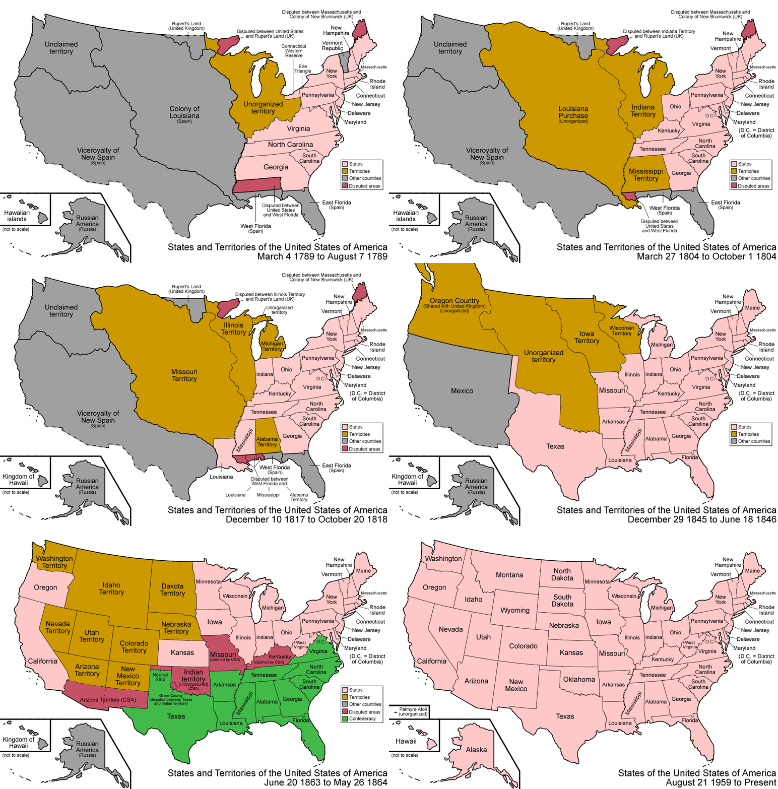
Every Map Has a Story: 250 Years of America
As America marks its 250th anniversary, we put together an animation tracing how the United States took shape, from the first map of the new federal government in 1789 through the admission of Hawaii in 1959. Not the short version from a textbook, but the whole strange, winding journey, told through the map itself. The…
-
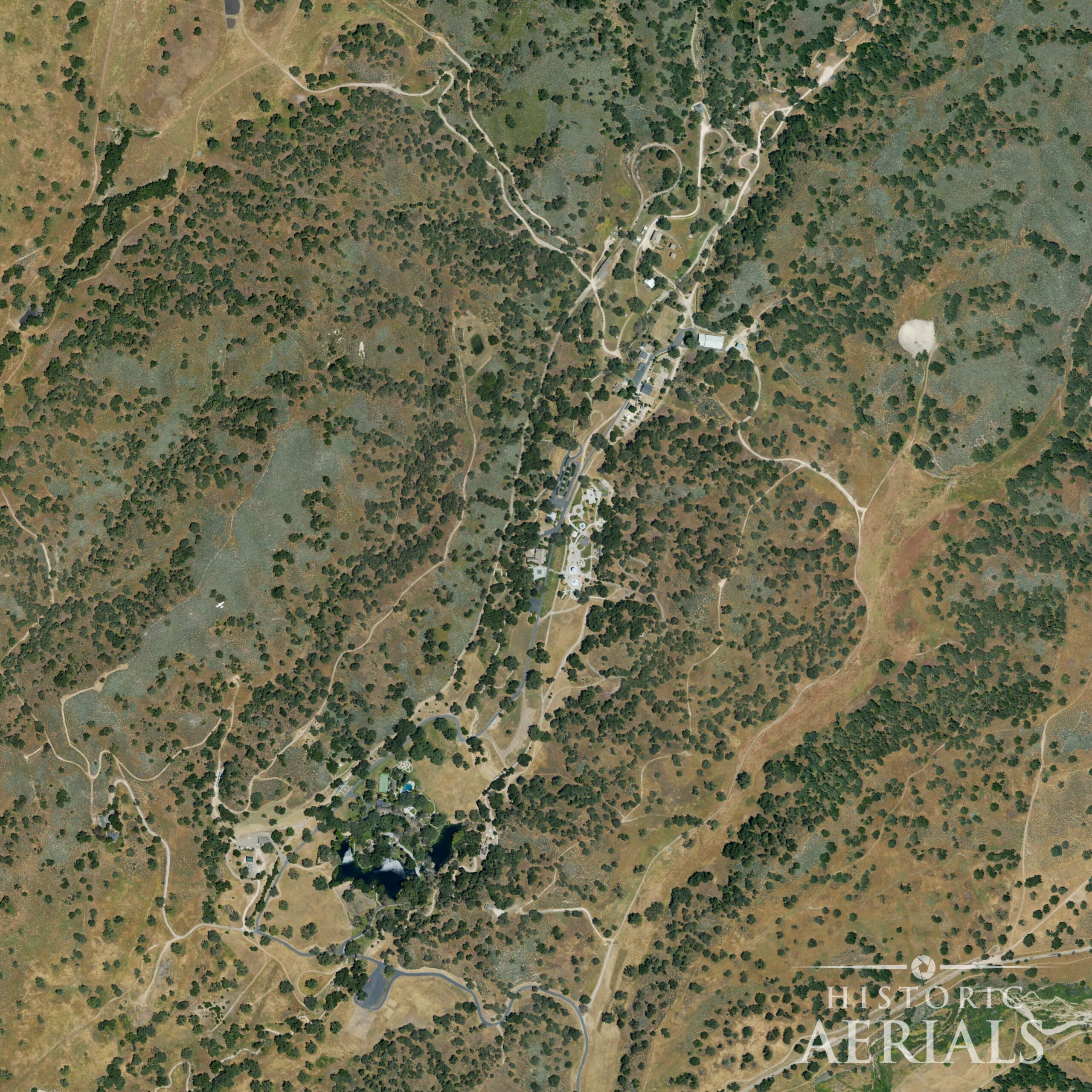
The Land That Outlasted Every Dream: Neverland Ranch From Above
Everyone is looking inside the mansion again. The recent releases of the blockbuster biopic, Michael, and the Netflix docuseries, Michael Jackson: The Verdict, has us peering at the rooms, the rides, the relics of Michael Jackson’s Neverland Ranch. It’s the same images that have been picked over for thirty years. We wanted to look at…
-
The Old Salt Road
I found a forgotten road with direct ties to the War of 1812. There are no historical markers there. Anyone I asked about it had no idea it even existed. I’ve long indulged in learning everything I can about the history of the places where I live. Reading every history book of the area that…
-
The Superstition Ho Hotel: Apache Junction’s Big Desert Bet
From above, the empty parcel barely explains itself. There is cracked pavement, scattered desert growth, and a few strange shapes still pressed into the ground. One of them looks like the faint outline of a swimming pool. Another suggests the footprint of a building too deliberate to be accidental. Historic aerial imagery gives the first…